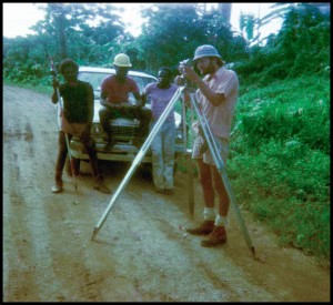
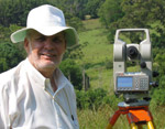
Once upon a time as a cadastral Mastamak on Bougainville Island
Time before ~ years 1974 to 1975 ~ on a verdant high Pacific Island
Mastamak Robert leading a Bougainvillean land boundary field surveying party
North-east coast of Bougainville Island, Papua New Guinea
.
___________________________________________________________________________________________________________
_________________________________________________________________________________________________________
___________________________________________________________________________________________________________
____________________________________________________________________________________________________________
____________________________________________________________________________________________________________
____________________________________________________________________________________________________________
____________________________________________________________________________________________________________
Back Story
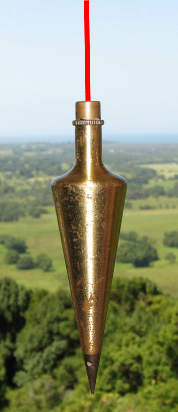
The above photographs, albeit some poor quality images, only tell a component of the procedures related to land boundary surveying. The foundation of a Certificate of Title for land ownership is based upon a plan of survey, undertaken and signed off by an authorised Land Surveyor.
Precision measurement is undertaken on the ground to reinstate old established land boundaries, and for the creation of new land boundaries, either in an urban or rural land context. Additionally, new land boundaries are required to be marked on the ground, and with respect to this Bougainville location, boundary markings were substantial concrete pegs, which would not rot in a tropical environment.
Attached to the field survey part of a job is investigation of old original plans of survey, land subdivision design, computations associated with plan of survey preparation, additional control survey and reference marking to comply with statutory requirements, with the final output being, the State authorised, approved and registered legal plan of survey.
Acknowledgements
Many thanks to Smith & Hard, Consulting Surveyors, Kieta, Bougainville, PNG, who employed me as a Registered Land Surveyor, during the period 1974 to 1975, on Bougainville Island.
My sincere gratitude to all participants, especially my Bougainvillean colleagues, involved with my survey work during my time on Bougainville Island.
My wife Gillian accompanied me onsite for the whole of my working period on Bougainville, living in whatever accommodations were available to us – she certainly made life easier for me. Without Gillian’s eyesight, this posting could not have been created and developed. For this crucial role, my extreme thanks go to my wife and amanuensis.
Where applicable, some photo negatives have been restored by Paul Full, Ace PhotoShop, Ballina, NSW.
References
Sinclair, James, Mastamak – The Land Surveyors of Papua New Guinea, Pub. 2001 – see page 327
Nelson, Hank, Taim Bilong Masta – The Australian Involvement with Papua New Guinea, Pub. 1982, based on the ABC Radio series produced by Tim Bowden
Bowden, Tim, Taim Bilbong Masta – The Australian Involvement with Papua New Guinea, ABC Audio Book
Oliver, Douglas, Black Islanders – A Personal Perspective of Bougainville 1937 – 1991, Pub. 1991
Linklater, Andro, Owning the Earth – The Transforming History of Land Ownership, Pub. 2013
Winchester, Simon, Land: How the Hunger for Ownership Shaped the Modern World, Pub. 2021
Association of Surveyors of PNG, September 2025 – Extract from Facebook
View the professional background of Robert Prikulis, Registered Surveyor
.
© Copyright to Robert and Gillian Prikulis, 2020
.


