Archive for the ‘Land Surveying’ Category.

The Land Survey Misclose ~ a perfection of plane trigonometry and coordinate geometry, as applied to cadastral survey practice.

For Gillian ~
Who really wanted to know
And was there from the beginning.

.

The land survey close computation is fundamental to the development of the cadastre.  A primary element of the Torrens Title land system is the inclusion of a title diagram reference in the issued Certificate of Land Title.  In New South Wales, a plan of  survey of the land parcel prepared by a Registered Land Surveyor, meets the requirements of a title diagram.

The external perimeter boundaries of a land parcel are delineated in a plan of survey by lines, each line being annotated with a bearing and a distance.  The accuracy and correctness of these stated measurements can be mathematically confirmed by the undertaking of a survey close computation.

.

.A diagram example of a plan of survey showing a green triangle shaped land parcel, comprising three ground points, with bearing and distance measurements detailed on the three red perimeter boundary lines.  These red lines may also be referred to as a closed traverse loop.

Background

In the mid-1960s, closed traverse computations were undertaken with the use of printed trigonometrical tables and a mechanical calculator.  The introduction of scientific programmable RPN calculators in the early 1970s, took the tedium out of the survey close computation process.  Current personal computer technology again dramatically improved survey computations through the use of purpose COGO and CAD software programs.

Increased computing power for land survey computations, lead to a move away from grid subdivision layouts to curvilinear land developments, blending in more with the topography.

Precision field measurement of lines between ground points, are accurately measured with modern total station instrumentation.  Angles or bearings and distances are measured electronically.  Distances measured are slope distances, subsequently reduced to the horizontal, and observed bearings are directions of lines relative to a map grid north.

For further reference reading, see my previously published article titled ~ Surveying computations and the land boundary Surveyor.

How the survey close computation works

A point position on a plane surface may be defined by rectangular coordinates, being an East and North coordinate value.  For Pt. 1 in the diagram, coordinates East 500.000 metres and North 500.000 metres, are arbitrarily set as the start point values for this three line traverse.

The bearing and distance of each traverse line, through trigonometry, can be transformed into an orthogonal North – South axis and East – West axis distance component.  View the three blue triangles edged in black in the diagram.

Computing N/S and E/W components for line 2 to 3
SIN 137° 10′ 20″ x 115.865 = 0.679797 x 115.865 = 78.764 ~ Easting component
COS 137° 10′ 20″ x 115.865 = – 0.733400 x 115.865 = – 84.975 ~ Southing component

.

Using these calculated N/S and E/W distance components, coordinates can be computed for all points sequentially, clockwise around the traverse loop.

Coordinates calculation for Pt. 2 ~ E 500.000 + 128.856 = E 628.856 ~ N 500.000 + 154.909 = N 654.909
Coordinates calculation for Pt. 3 ~ E 628.856 + 78.764 = E 707.620 ~ N 654.909 – 84.975 = N 569.934
Coordinates calculation back to start Pt. 1 ~ E 707.620 – 207.620 = E 500.000 ~ N 569.934 – 69.934 = N 500.000

.

The correctness and accuracy of the measured  traverse loop can be checked by the comparison of the original starting coordinates, with coordinates generated sequentially through the traverse back to the initial starting point.  The traverse misclose is the difference between the initial coordinates and final coordinates back to the starting point, generated through the traverse.  For this traverse, the misclose is E 0.000 and N 0.000.

A typical “real life” survey misclose for the traverse loop, as shown in the diagram, would be of the order of about 0.025 metres.  This is conventionally expressed as the ratio of about 1 : 21,450, which meets the criteria for a rural land boundary survey.  The ratio represents the misclose related to the traverse loop perimeter.

.

A screenshot of a DOS based survey close computation, PC software vintage about 1990, showing the traverse computation close of the red sided triangle.

.

Screenshot from CDS Version 2.3 software, 2011, showing listing output for the red triangle traverse diagram.

.

Screenshot of the HP 15c Scientific RPN Programmable Calculator, first available in about 1983.

HP 15c RPN programmable calculator, old technology at its best.  Find as a PDF attachment, my instructions in the use of a HP 15c in undertaking a survey close traverse computation, together with the necessary program steps to be inputted in the HP 15c, to enable the running of this Survey Close program.

Something for future consideration ~ the mathematics of a triangle on a curved surface, as applied to the astronomical triangle.  Watch this blog.

Acknowledgements:

Under my gentle supervision and direction, Gillian road tested all the necessary survey computations in the preparation of this article, as well as undertaking all the transcriptions.  Well done GFP.  Gillian absorbed and learnt a lot, but no exams required !

Special thanks to Sam, our computer guru, who introduced us to VIRTUAL BOX, which enabled the use of Windows XP in a macOS Monterey environment.  This permitted the running of my old land survey software on an iMac PC.

References:

Foxall, H.G., Handbook for Practising Land and Engineering Surveyors, Pub. 1957, NSW Institution of Surveyors, Sydney.

CDS Professional Solutions, Civil Design & Survey software, CDS 2.3, March 2011.

Mackie, J.B., The Elements of Astronomy for Surveyors, Pub. 7th edition 1971, Charles Griffin & Co., London.

HP 15c  Scientific RPN Calculator app, Apple macOS Monterey, App Store.

Triangle Solver app, designed for iPad and iPhone, iOS 9.0 or later, App Store.

.

Time before ~

An elated and exhausted Gillian walking out of a rural survey job in the Byron Hinterland.  Note the extendable prism pole, holding an attached mini reflecting prism, with the Sokkia Total Station instrument in the left corner foreground.  Again, Gillian at her surveying best. Photo taken by Robert.

Robert’s malaga fa’aSamoa ~ the initial establishment of a geodetic surveyed control traverse network over the islands of Upolu and Savaii, 1983 – 1985.

An Island Landfall
28 July 1888

“The first experience can never be repeated.
The first love, the first sunrise, the first South Sea island,
are memories apart and touched a virginity of sense.”

Robert Louis Stevenson
In the South Seas

.

The large high islands of Savaii and Upolu, known as Western Samoa in 1985, are separated by the smaller islands of Apolima and Manono, located in the Apolima Straits.

On my iPhone, Siri advises me that Apia, Samoa, is located 3,944 kilometres as the crow flies from Coorabell.


______

Location description Pacific islands of Samoa – pdf

.

It was the most interesting of times.  It was the most challenging and testing of times.  And certainly worth revisiting with the scraps of evidence that I have still got left in 2022.  My survey work in Samoa has to be considered in the context of that time period, with no internet, no modern precision GPS technology, no mobile phones, personal computers in their infancy, snail mail,  and no broadcast television in Apia.

During the period 1983 to 1985, I worked as Lead Project Geodetic Surveyor, Department of Lands and Surveys, Apia, Western Samoa, under the Australian Staffing Assistance Scheme (ASAS) and Australian Development Assistance Bureau (ADAB).  Following strict Samoan cultural protocols during the field survey phases, I worked with a variety of Samoan Departmental staff to complete my involvement with this project.

My Brief, as determined by Governments’ Memorandum of Understanding. The supervision and execution of a circum-insular traverse of the two main islands of Western Samoa and the direction of the adjustment of the overall scheme. To establish a survey control network for Western Samoa which will serve as an accurate base for future mapping.”

Proposed uses of this surveyed geodetic control network – survey ground control for topographic mapping by photogrammetry, for the consideration of  the correct mathematical determination of  Western Samoa’s Exclusive Economic Zone (EEZ), for hydrographic mapping, for scientific purposes,  for the on-going training of Graduate Samoan Surveyors, and for the basis of the establishment of an integrated survey grid with the cadastre of Western Samoa.


Outlook from coastal road on Upolu looking towards the sea.

.

The survey field work for the control traversing, with measured lines of up to 12 kilometres plus to a bank of 9 circular reflecting prisms, was undertaken in 3 basic stages.  Firstly – reconnaissance, secondly – marking geodetic control stations on the ground with minor vegetation clearing if necessary, and thirdly – field survey observations for angular and distance measurements utilising Wild T2, one second of arc theodolite, and Wild D1 20 Distomat infra-red electronic distance measuring equipment, EDM, capable of millimetre accuracy.

A total of 78 new geodetic control survey stations were established on the islands of Upolu, Manono, Apolima and Savaii by myself, in conjunction with Departmental survey field party teams plural, over the period 1983 to 1985.  Ground survey control stations were either concrete observing pillars, brass plaques set in concrete with an iron witness post, or galvanised iron pipes set in concrete – dependent on site terrain, accessibility, and distance from the survey vehicle.  My survey project measured field observations were recorded in sixteen survey field books, numbered 746 to 761 inclusive, held by the Survey Office, Department of Lands and Surveys, Apia.

I have attached as a PDF, a barely readable copy of the survey plan detailing the overall control traverse network, highlighted in red, completed by myself, over the main islands of Upolu and Savaii, together with measured connections between these islands.

.

Principal senior field survey assistant Taofia, who assisted me throughout the whole of this project.

“Manuia le ta’avale, Robarti”

.

Island circumference Geodetic control traverses were independently checked by solar astronomical azimuth observations on specified traverse lines on both Upolu and Savaii.  Measured  traverse loops survey miscloses were checked by plane projection coordinate computations, and met standard specified criteria.  The Savaii traverse loop perimeter was a total length of 174.4 kilometres.

Additionally, the computed Geodetic latitude and longitude of  my control traverse points, were compared with the six previously established Doppler satellite stations’ coordinates, undertaken by the Royal Australian Survey Corps on Upolu and Savaii in 1982.  Acceptable minor differences were noted between these two seperate Geodetic surveys.


Left – Samoan Survey Technician, Finauga, operating Wild T2 instrument and Wild D1 20 Distomat EDM, on top of concrete survey pillar, Geodetic control traverse survey station, Upolu.  Top right – Field assistant with erected over the station mark, bank of 9 circular reflecting prisms, for EDM distance measurement.

Toyota Hilux 4WD survey vehicle, tailgate down,  and field staff, on the vehicular and passenger ferry travelling from Mulifanua Wharf, Upolu, to Salelolonga Wharf, Savaii.  A 24 hour plus wait to get the vehicle on this ferry.

.


________

Top left – Arriving at Apolima Island                                 Top right – Guest accommodation fale, Apolima Island

___________

Top left – Samoan Matai’s daughter on Apolima Island          Top right – Survey field party leaving Apolima Island

Apolima Island is the rim of an old extinct volcanic crater.

.

Necessary complex Geodetic and map projection coordinates computations and adjustments, were undertaken on an Apple IIe computer, with Geodetic and mapping software provided by Scientific Software, Brisbane, Australia.

The Universal Transverse Mercator Projection on the WGS 72 spheroid, with a 6 degree zone width, was the basis for the computation of coordinates on the UTM grid for the Geodetic control traverse survey of Western Samoa.  An alternative map projection, which may have been  more suitable for Western Samoa, in consideration of the shape, location and size of the two main islands, was a Transverse Mercator Projection with a 2 degree zone width.  Final adopted mapping coordinate data was supplied for both the 6 degree and 2 degree zone widths.  Refer to extract of data shown below.  Note, the Geodetic software provided at the time could not compute west longitudes, and accordingly, they are described in the data in an east format.

An extract of the title and contents only of my final submitted comprehensive written report, of my project involvement, is attached as a PDF.

.

Extract of stations’ summary of Geodetic control data for part of Savaii – Geographics, Latitudes are south, Longitudes are east – Transverse Mercator Projection grid coordinates east and north, Zone is 2 degrees width, Central Meridian 172 degrees west, Zone 5, World Geodetic System 1972 spheroid.  WGS 72.

.

Robert undertaking precision angle observations with the Wild T2 instrument at a Geodetic control traverse station on Savaii.  This station was located on an old black volcanic lava field in close proximity to the ocean coast.  Note the white large surf spray in the background.  My Samoan field assistant is booking my readings to the field book, whilst holding one of the Tait 2-way communication radios. Access to this station necessitated a 3 hour walk from the survey vehicle, which was left at the nearest trafficable road.  Photo was taken by Taofia.

__________________

O loʻu loto fa’afetai tele i aʻu uo uma Samoa.
Fa’afetai i mea uma mo nei tau taua.
Loʻu taimi ma loʻu aafiaga i Samoa e leʻi faagaloina.
~ Robarti

___________________

Fai le la !  Lelei le matagi !
Make sail !  The winds are fair !

____________________

.

Acknowledgements:

The Australian Government through ADAB, provided all Geodetic measuring equipment, Apple IIe computer, Geodetic computation software, Toyota Hilux 4WD vehicle, and an aluminium dinghy with outboard motor for this project.

The assistance of Tony Godfrey-Smith, Resident Australian High Commissioner to Western Samoa,  during my project period.

Without Gillian’s eyes and dedicated and passionate involvement, this article would not have been produced.  Malo tele lava Gillian.  Special thanks to our son Sam for helping to restore some of the old damaged photos.

References:

Western Samoa – The Land, Its People, The Way of Life, Cradle of Polynesia, Western Samoa Visitors Bureau publication, 18 November 1981.

Manual of the New South Wales Integrated Survey Grid, NSW Department of Lands, Sydney, January 1976.

Stevenson, Robert Louis, A Footnote to History – Eight Years of Trouble in Samoa, Pub. 1912, Swanston Edition.

Stevenson, Robert Louis, In the South Seas, Pub. 1924, Chatto & Windus, London.

Turner, George, Samoa, a Hundred Years Ago and Long Before, London Missionary Society, First Pub. 1884, London. Ebook – Project Gutenberg, 1 Dec. 2004.

The Cyclopedia of Samoa, Illustrated. Published under the Patronage of His Excellency Dr Solf, the Governor of German Samoa, 1907, Sydney, McCarron Stewart & Co.

Irwin, George, Samoa – A Teacher’s Tale, Pub. 1965, Cassell, London.  Maps provided above sourced from this pub.

Freeman, Derek, Margaret Mead and Samoa – The Making and Unmaking of an Anthropological Myth, Pub. 1983, Australian National University Press, Canberra.

Holmes, Lowell D., Quest for the Real Samoa, Pub. 1987.

Barr, Donna Marie, My View From the House by the Sea, Pub. 2022, White Hawk Press.

.

Time out for Robert and Gillian on Upolu.

.

Robert produced this posting with Gillian, as part of his personal therapy, while recovering from an Ischemic stroke.

Once upon a time as a cadastral Mastamak on Bougainville Island

Time before ~ years 1974 to 1975 ~ on a verdant high Pacific Island

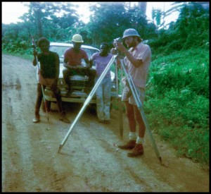
Mastamak Robert leading a Bougainvillean land boundary field surveying party
North-east coast of Bougainville Island, Papua New Guinea

.


___________________________________________________________________________________________________________


_________________________________________________________________________________________________________

___________________________________________________________________________________________________________

____________________________________________________________________________________________________________

____________________________________________________________________________________________________________

____________________________________________________________________________________________________________

____________________________________________________________________________________________________________

Back Story

The above photographs, albeit some poor quality images, only tell a component of the procedures related to land boundary surveying.  The foundation of a Certificate of Title for land ownership is based upon a plan of survey, undertaken and signed off by an authorised Land Surveyor.

Precision measurement is undertaken on the ground to reinstate old established land boundaries, and for the creation of new land boundaries, either in an urban or rural land context.  Additionally, new land boundaries are required to be marked on the ground, and with respect to this Bougainville location, boundary markings were substantial concrete pegs, which would not rot in a tropical environment.

Attached to the field survey part of a job is investigation of old original plans of survey, land subdivision design, computations associated with plan of survey preparation, additional control survey and reference marking to comply with statutory requirements, with the final output being, the State authorised, approved and registered legal plan of survey.

Acknowledgements

Many thanks to Smith & Hard, Consulting Surveyors, Kieta, Bougainville, PNG, who employed me as a Registered Land Surveyor, during the period 1974 to 1975, on Bougainville Island.

My sincere gratitude to all participants, especially my Bougainvillean colleagues, involved with my survey work during my time on Bougainville Island.

My wife Gillian accompanied me onsite for the whole of my working period on Bougainville, living in whatever accommodations were available to us – she certainly made life easier for me.  Without Gillian’s eyesight, this posting could not have been created and developed.  For this crucial role, my extreme thanks go to my wife and amanuensis.

Where applicable, some photo negatives have been restored by Paul Full, Ace PhotoShop, Ballina, NSW.

References

Sinclair, James, Mastamak – The Land Surveyors of Papua New Guinea, Pub. 2001 – see page 327

Nelson, Hank, Taim Bilong Masta – The Australian Involvement with Papua New Guinea, Pub. 1982, based on the ABC Radio series produced by Tim Bowden

Bowden, Tim, Taim Bilbong Masta – The Australian Involvement with Papua New Guinea, ABC Audio Book

Oliver, Douglas, Black Islanders – A Personal Perspective of Bougainville 1937 – 1991, Pub. 1991

Linklater, Andro, Owning the Earth – The Transforming History of Land Ownership, Pub. 2013

Winchester, Simon, Land: How the Hunger for Ownership Shaped the Modern World, Pub. 2021

View the professional background of Robert Prikulis, Registered Surveyor

.

© Copyright to Robert and Gillian Prikulis, 2020


.

Byron Shire Land Surveyor Consultancy for Sale ~ whole or part

Components sale offer, my Land Surveyor Consultancy practice, located 10 minutes from Byron Bay

My Coorabell based sole practitioner Land Surveying Consultancy, located 10 minutes from Byron Bay, within the Byron Shire, is available for purchase  ~  whole or part. My business sale offer would be suitable for a New South Wales Registered Land Surveyor seeking a professional and lifestyle change, working in the eclectic Byron Shire, on the far north coast of NSW.


Business offer components for sale of my Coorabell based Land Surveyor Consultancy

1. Survey practice business intangibles ~ entree ticket, intellectual property, my goodwill, market presence ~  inclusive of my survey practice jobs documentation in hardcopy format.  ( My land and property survey search sold as separate component 3. )

2. On request, my current rate and variety of jobs enquiries, will be supplied. My onward land survey jobs enquiries referral, to the purchaser, by negotiation. Components 1 or 2, cannot be purchased separately.

Optional components 3 & 4

3. Extensive cadastral land and property survey search for the Byron Shire, supplied in digital format.  All search items offered as one lot only.

4. Modern array of practical field and office land surveying equipment offered as one lot only ~ inclusive of Sokkia CX103 Reflectorless 3″ Total Station instrument, brand new and still under warranty ~ SOLD.   The balance of the survey equipment may be purchased separately.  Optional availability to buy also ~ Stanley, The Eltham, 20″ arc Vernier Theodolite in original wooden case, and Curta mechanical calculator, with manual.

For your confidential initial enquiry, phone Robert on (02) 6684 7799.

Any proposed sale and terms will be subject to mutually acceptable, signed off,  formal legal contract.

Vincite opus ~ facis opus ~ mercedem


.

.” This is what has most impressed me and may well be a shallow thing, but I have admired most of all expertise, the quality of being strictly professional.  This must be understood to extend to every aspect of living within the individual purview so that the business of having lived has been done, in all directions, with competence, its obligations discharged without blemish, its satisfactions achieved in the knowledge of their excellence. “Lucius Beebe.

.

.

.


Some experiences of a Land Surveyor with Macular Degeneration ~ growing an information resource for better future eyesight outcomes.

Regeneration ~ not degeneration


compassion               creativity               courage

.

Caution alert ~ Dear reader, this narrative is about vision loss.  Should you find this distressing, please leave this page.  I also am stepping out of my personal comfort zone in writing and publishing this article.

The first port of call for any eyesight concern is always the medical professional.

The primary rationale of this journal entry is to plant a seed for the development of an organic knowledge base, in the public interest, specifically for probable future cures for the wet form of Macular Degeneration.  Eyesight malfunctions are numerous, and this journal entry is specific to the wet form of Macular Degeneration only.

My commentary is from the perspective of a non-medical layperson, who has experienced wet Macular Degeneration and it’s profound impacts for the past twenty years.  Again, my purpose is to seek out information for the benefit of all, of the latest developments with respect to the medical treatment of wet Macular Degeneration.  Relevant contributions addressing the theme of this page, would be most welcome.

How to instantly lose the best part of your eyesight, with no current prospect of a recovery

A very basic explanation of the vision process is firstly required.  One’s eyesight consists of two primary components – peripheral vision and macular vision.  Fine accuracy vision is provided by the macular, which enables one to read normally and view detail.

Out of the blue, twenty years ago, at aged 47 years, I lost the central macular vision of my right eye in an instant and was introduced to the world of Ophthalmologists and the terminology, the wet form of Macular Degeneration.  Medical treatment available at that time, did not recover my lost central sight.  Subsequent emphasis was directed to preserve the healthy eyesight of my good left eye.  I was able to continue to work successfully as a professional Land Surveyor.

.

.

Out of the blue ~ Round 2, down for the count

My greatest fear was that this could happen to me again.  After twenty years of constant monitoring and checking of my good left eye by Ophthalmologists, my dreaded fear happened suddenly in late 2012, and again, I lost the central vision in my good healthy eye to the wet form of Macular Degeneration.  The wet form of Macular Degeneration is precipitated by a blood vessel eruption or leakage in the retina, which may cause irrepairable damage to the macular, resulting in central vision loss.  On this second occasion, the haemorrhage occurred under the retina.

Although the blood vessel haemorrhages were twenty years apart, medical treatments undertaken, inclusive of intraocular gas applications, were almost identical.  The new exceptions being in 2012/2013, the use of laser retinal scanning imagery and follow-up injections of Lucentis into my left eye.  In my case, leading to no vision improvement in this eye.

For me currently, and as it was twenty years ago, there is no cure to recover this lost vision.  If I’m  incorrect in my statement, I and many others would gladly like to be advised of an available treatment solution.  In my situation, because of family history, medical experts concur that I had a genetic predisposition to the wet form of Macular Degeneration.

My central area of vision for both eyes is obscured, replaced by a featureless grey smudge, with no visual precision – just a blur.  Letters and words cannot be identified.  The remainder of my peripheral vision can identify lines of text, however they cannot be read by me.  Images that I can see are blurry, distorted, sometimes with parts missing, with no sharp focus.

For me, the exponential domino effect of not being able to read in everyday living, has had the most profound impacts.  My passion to practice as a Consultant Land Surveyor has been stopped stone cold.

It’s not lights out ~ what’s next for tomorrow

Ophthalmologists, optometrists and orthoptists have advised me that there is no current cure to recover vision loss, caused by the wet form of  Macular Degeneration.  A damaged or atrophied macular (end stage disciform scarring and geographic atrophy) does not necessarily imply “lights out” – as put to me by one medical expert.  In my case, some peripheral vision remains, facilitating a reduced eyesight.  Unlike cataract removal surgery and the wonderful clear lens replacement, there is no universal plug-in or external optical fix for a damaged macular – not just yet.

A breakthrough in vision restoration for the future, may lie in the direction of a much sought after cell regenerative process.  Regenerative, meaning the repairing of an eye component part, that the body cannot repair naturally.  My layman’s speculation is that a practical successful treatment for wet Macular Degeneration, resulting in correct vision recovery, is more than 10 years away. On behalf of the wider affected community, I dearly hope that I’m wrong.

Key information links

Six years in the murk, but not lights out

Eye on the Cure

My Macular Degeneration Journey ~ by Linda and Sue

eSight ~ digital eyewear for people with low vision

Eye Conditions

A current organic knowledge base in chronological order ~ seeking future treatment options for wet Macular Degeneration ~ see 100 links

Gene-editing tool CRISPR used in blind US patient to attempt to restore sight

Wet Macular Degeneration ~ a valuable animated video explanation

The Patriot ViewPoint – The Blind Life

Why is Assistive Technology so Expensive – The Blind Life

People with disability both liberated and left behind by today’s tech

Legally blind photographer

Stem cell-based retina therapy to treat blindness – University of California, Irvine.

New Stem Cell Treatment Reverses Vision Loss in 2 Patients

Gene therapy for inherited eye disease – MDFA

Stem cell therapy reverses sight loss and lets people read again

Macular Degeneration: Stem Cells Restore Sight in Small Study

First serious adverse reaction to iPS-derived retinal cell transplant reported

Life After Sight Loss ~ Podcasts

Seeing AI App  ~  Artificial Intelligence

Florey Medal winner sets sights on wet macular degeneration cure

eSight 3 Launches in Australia

Macular Degeneration: A stem cell treatment – video, a fair explanation

New Research: Gene Editing as a Potential Treatment for Wet Macular Degeneration

Legally blind ~ The Blind Spot ~ video

A Demonstration of the IrisVision Electronic Glasses

Japanese man is first to receive ‘reprogrammed’ stem cells from another person

How to use a USB microscope for a reading aid ~ video

Winner: GiveVision, Stan Karpenko, London

Patients Lose Sight After Stem Cells Are Injected Into Their Eyes

Macular Disease Foundation Australia – Extract Research Update, December 2016

EYE HOPE  ~ a site for sore eyes ~ curated by Reid Johnson, Seattle, USA

ORCAM – See for yourself

The Stem Cellar

Dry AMD Treatment’s “major achievement”

Basic Stem Cell Terminology

Stem cell cure for blindness tested – BBC News

NuEyes

Osterhout Design Group Teams with NuEyes for Solution to Help Those with Low Vision

Skin-To-Eye Stem Cell Transplant Partially Restores Eyesight Of Woman With Age-Related Macular Degeneration

Japanese scientists have used skin cells to restore a patient’s vision for the first time

‘Miracle’ cells could cure blindness

CRISPR Used to Repair Blindness-causing Genetic Defect in Patient-derived Stem Cells

My macular vision loss strategies ~ 2016

Cautionary comments concerning stem cell therapy and macular degeneration

Stem Cell Trial Aims to Cure Age-Related Macular Degeneration

Restoring vision with stem cells

RXI-109 May Reduce Retinal Scarring

‘Big step forward’ in new treatment for age-related macular degeneration

Restoring vision with stem cells

Stem cells help a local blind man see

Restoring vision with stem cells

Stem cell op could bring back sight for millions: UK breakthrough

A New Treatment for Macular Degeneration

Hope for stem cell therapy in macular degeneration

Faulty Immune Cells May be a Cause of Vision Loss in Wet Macular Degeneration

Are stem cells the future for treating macular degeneration?

Pivotal Clinical Trial Program Design for Stargardt’s Macular Degeneration ~ Ocata Therapeutics

Many Stem Cell Clinical Trials for Macular Degeneration

Blindness cure is in sight

Stem Cells Allow Nearly Blind Patients to See

Successful retina transplant sparks hope

Intra Ocular Lens AMD – Hubble Implant

Stem Cell Trial Yields Surprising Results

Hope for blind as scientists find stem cell reservoir in human eye

First lab grown stem cell implanted to treat macular degeneration

MIT finger device reads to the blind in real time

Summary of Research and Developments, 2013-2014

Stem-Cell Treatment for Blindness Moving Through Patient Testing

Scientists make major breakthrough in Age-Related Macular Degeneration therapy

A Continuing Clinical Trial for Dry Age-Related Macular Degeneration

Stem cells transplants restore sight to blind mice

Macular degeneration: Incurable, but progress being made

Nano innovation could mean eye injections are a thing of the past

Eccentric Viewing in Central Vision Field Loss, CFL ~ pdf

Review of the MD evReader by Robert Prikulis ~ pdf

New iPad app for people with sight loss

MD evReader App ~ You Tube

Stem Cell Trial Enrolling Patients

Gene Therapy May Help Against Rare Blinding Disease

Cells programmed back to embryonic state using acid bath may provide way to grow new organs

Blindness Cure Hope: Genetically Modified Virus Restores Sight in Choroideremia Patients

The Day I Got My Sight Back ~ BBC documentary video 2013

Scientists ‘print’ new eye cells

New hope for patients with macular degeneration

Stem Cell Treatment ~ Research Update December 2013, MD Foundation Australia

Macular Disease Foundation Australia

Webvision ~ Age-Related Macular Degeneration (AMD) by Gregory S. Hageman

Potential topical treatment for macular degeneration

New Treatment For Dry & Wet Macular Degeneration Shows Great Promise

The London Project to Cure Blindness

Historic Japan Stem Cell Trial Approved

‘Big leap’ towards curing blindness in stem cell study

Glasses could correct eyesight of macular degeneration sufferers

Bioengineered virus will improve gene therapy for blinding eye

Video ~ New lease on sight ~ Israeli start-up gives visually impaired a way to read

Bionic eye prototype unveiled by Victorian scientists and designers, Monash University

Stem-cell treatment restores sight to blind man ~ New Scientist – Health

The bionic eye – how does it work ? ~ Bionic Vision Australia

E-Scoop and Life After Vision Loss for Patients Suffering With Macular Degeneration

E-Scoop and Doctor Writes Guide for Macular Degeneration Eyeglasses

Vision Australia ~ blindness and low vision services

Your links, emails and comments are welcome.

Relevant submitted information will be published on this page.

Help grow an information resource for better treatment outcomes for Macular Degeneration.

Email Robert

with my gratitude to Gillian, Sam and Tee

regeneration

The regeneration of Macular Degeneration current interim report card ~ 12 best statements influencing better future eyesight outcomes.

What is the current state of play


” About 110,000 Australians have wet Macular Degeneration ” ~ Macular Disease Foundation Australia, Research Update Summary Paper, page 4  ~  December 2012.

My following extracts are a synopsis of latest developments as detailed in the reference links noted on my previous Journal Blog narrative, “Some experiences of a Land Surveyor with Macular Degeneration….” ~  my aim being to provide a layman’s snapshot interpretation of current best practice paradigms out there.  Your additional helpful comments or suggestions would be welcome.

12

” The treatment is based on retinal pigment epithelium (RPE) cells that have been grown from embryonic stem cells. A surgeon injects 150 microliters of RPE cells—roughly the amount of liquid in three raindrops—under a patient’s retina, which is temporarily detached for the procedure. RPE cells support the retina’s photoreceptors, which are the cells that detect incoming light and pass the information on to the brain….the company has reported impressive results with one patient, who recovered vision after being deemed legally blind.  “  ~  16 April 2014

11

” Dr Kang Zhang, chief of ophthalmic genetics at UC San Diego, is studying AMD from several angles. He’s investigating genetic variants associated with the disease to better understand how it develops, along with angiogenesis inhibitors for “wet” AMD.  “People at the end stage of end-stage macular degeneration have scar tissue with a loss of photoreceptor cells, so stem cell therapy is the only hope for them,” Zhang said.  For those patients, Zhang is studying how to regenerate an entire retina.  One approach is to use 3-D “bioprinting” of cells to assemble a retina.  Zhang said he and his colleagues are attempting to re-create the embryonic environment in which retinas naturally grow.  “Because the retina is a three-dimensional structure, we have to use ‘bioprinting’ to lay down scaffolds,” Zhang said.  His team is working with a variety of animal and human cells. ” ~ 12 March 2014

10

” While choroideremia is a rare disease, affecting about one in every 50,000 people, doctors believe the process used to treat it could be turned toward more common inherited eye disorders, such as macular degeneration or retinitis pigmentosa. ” ~ 13 February 2014

9

” The team used a genetically modified virus and inserted it into the cells in the retina of the eye without causing damage. The first six patients to receive the treatment had all shown improvements to their vision in dim light, with two being able to read more lines on the eye chart. ” ~ 16 January 2014

8

“….The cells, called induced pluripotent stem (iPS) Cells, will be morphed into retinal cells, then given to six patients with a major cause of blindness: age-related macular degeneration (AMD)….IPS cells are hailed as the perfect compromise cell. They are adult, so uncontroversial; multi-potent like an embryonic cell, so relatively powerful….”  ~  14 August 2013

7

“…. Damage to the retina causes their sight to become blurry and distorted….Patients use a computer mouse to adjust the Amsler Grid until they can see it perfectly….Using complex algorithms he can produce personalised lenses that compensate for the distortions, and is developing spectacles and contact lenses….We have to eliminate the distortions in macular degeneration with a complex compensation….” ~ 15 August 2013

6

” ….The eye is one of the most advanced fields for stem cell research….It is relatively simple as the light sensing cells only have to pass their electrical message on to one more cell in order to get their message to the brain….Now the London-based team have shown it is possible to replace the light-sensing cells themselves, raising the prospect of reversing blindness….The study showed that these cells could hook up with the existing architecture of the eye and begin to function….” ~  22 July 2013

5

“….Building upon 14 years of research, we have now created a virus that you just inject into the liquid vitreous humor inside the eye, and it delivers genes to a very difficult-to-reach population of delicate cells in a way that is surgically non-invasive and safe….the viruses penetrated cells spottily across the retina, but almost completely in the very important fine-vision area called the fovea. Current viruses do not penetrate foveal cells at all….Schaffer predicts that the viruses can be used not only to insert genes that restore function to non-working genes, but can knock out genes or halt processes that are actively killing retina cells, which may be the case in age-related macular degeneration….”  ~  16 June 2013

4

” An experimental stem-cell treatment has restored the sight of a man blinded by the degeneration of his retinal cells. The man, who is taking part in a trial examining the safety of using human embryonic stem cells (hESCs) to reverse two common causes of blindness, can now see well enough to be allowed to drive….”  ~  20 May 2013

3

” The bionic vision system consists of a camera, attached to a pair of glasses, which transmits high-frequency radio signals to a microchip implanted in the retina. Electrodes on the implanted chip convert these signals into electrical impulses to stimulate cells in the retina that connect to the optic nerve. These impulses are then passed down along the optic nerve to the vision processing centres of the brain, where they are interpreted as an image….”  ~  20 January 2013

2

“….Recently developed new E-Scoop lenses from Holland now enable doctors to help patients with one of the chief complaints associated with macular degeneration – cloudy vision….The lens has four distinct properties that make vision clearer and sharper, with reduced glare….The yellow tint improves contrast, the prism moves the image away from the damaged macular area, the thickness of the lens, combined with its special “base” curve, makes objects appear slightly larger….”  ~  9 September 2012

1

“….As our understanding of the pathogenesis of AMD continues to improve, so does the prospects for new diagnostic and therapeutic approaches. Hopefully, we will eventually eradicate AMD and dramatically improve the quality of life in our older generation.” ~ June 2012


Help grow an information resource for better treatment outcomes for Macular Degeneration.

Email Robert

with my gratitude to Gillian, Sam and Tee

Dictated to my wife, Gillian

regeneration

Land boundary dispute resolution within the NSW Byron Shire. The unmaking of adjoining neighbours’ demarcation myths.

Folktales about plowmen who encroach upon their neighbours’ fields ~ ” Before the permanent allotment of lands, to every peasant, in sowing time, so much of the field or mark was assigned as was just and appropriate, and boundary posts were driven between his and his neighbour’s allotment. Whoever removed such marks, though he might escape punishment in this world, could find no rest in the grave, but by way of penalty must plough every night on the spot where his sin lay hidden.” Dishonest Plowman Legends , D. L. Ashliman

As a NSW Registered Land Surveyor working in the Mullumbimby, Byron Bay and Bangalow localities, I occasionally receive enquiries from distressed property owners concerning, from their perspective, supposed land boundary disputes with their adjoining neighbours. In this article I will attempt to clarify key relevant issues and highlight perceived property owner misconceptions.  Water boundaries are excluded in this review.

Contrasts in the ownership of land experience can vary from ” Bliss “, as shown in the Windows XP, icon “Bliss” cartoon image above ~ to the unwelcome personal confrontation of a perceived land border, demarcation, land boundary dispute ~ being contentions between adjoining property owners, attempting to protect their own interests. Their perceptions are based sometimes on doubtful evidence, which requires factual land survey investigation.

How land boundaries are created in the first instance and associated responsibilities

In the State of NSW, land boundary rules of law are created by the Parliament, administered by the Government and interpreted by the Judiciary. In a worst case scenario, the absolute final arbitrator of the location of a land boundary on the ground is a Court of Law. The NSW Registered Land Surveyor is specially qualified, trained and has authorised competence in dealing with and resolving most land boundary issues.

The boundary limits of land ownership are accurately quantified in the quaintly termed ” title diagram “, as specified in the Certificate of Title (CT) of the individual land parcel.  Currently, this diagram is actually a precisely surveyed and carefully prepared plan of land survey, referred to as a Deposited Plan of Survey ( DP ), and meeting the strict requirements of the Surveying and Spatial Information Act 2002 Surveying and Spatial Information Regulation 2006 – ( 2012 from 1 September ), and the Registrar General’s Directions, NSW Land & Property Information ( LPI ).

Lodged DPs for the creation and subsequent reinstatement of land boundaries, are required to be accompanied by an extensive Checklist meeting statutory requirements, and signed off by the Registered Land Surveyor undertaking the boundary survey.

Delineated land boundaries are shown in the DP with accompanying corner reference marking details and State control surveyed connections for the future purpose of boundary reinstatement, if required.

The Registered Surveyor responsible for the surveyed DP, makes a mandatory legal declaration in the Survey Certificate panel contained within the separate DP Administration Sheet, stating that the survey was carried out in accordance with the statutory regulations.  There is no provision within this Survey Certificate, see above, for boundary survey work to be undertaken ” under supervision “. The NSW Board of Surveying and Spatial Information ( BOSSI ) issues a photograph identification card to Registered Land Surveyors, for the authorisation of entry to land for survey purposes.

In modern land survey practice, the land boundary dispute description statement is usually a misnomer

The established doctrine of indefeasibility applicable to Torrens title land, refers to the State guarantee as to certainty of ownership of land, inclusive of land boundaries. In the case of Limited Title, land boundaries are not guaranteed.

In my view, modern NSW land boundaries can be construed as land boundaries created since the introduction of precision electronic distance measurement for cadastral surveys in the early 1970s.  Additionally, from this period onwards, NSW survey regulations provided for improved  reference marking and survey control connection to selected land boundary corners in the DP.  This improved technology, with better survey monumentation, resulted in the accurate reinstatement of land boundaries, when required.

Simply put, with modern land boundary surveys, there is usually no doubt as to where a title boundary is on the ground.  Depending on local circumstances, more office investigation and field work may be required to reinstate a particular land boundary correctly in its original position, especially where original survey monuments are gone.

Accordingly, the description that ” an issue is a land boundary dispute “, is a misnomer.  With modern boundary surveys, the validity of a correctly reinstated land boundary on the ground, can be considered not to be in contention.  The ground land boundary location generally cannot be disputed, but rather the real issue being, contentions between adjoining neighbours regarding structures and/or vegetation, related to the correctly determined and known ground boundary position.

Separating the fundamental issues of contention and dispute

The ground location for a particular land boundary may not be known by adjoining land owners for a variety of reasons.  Original ground surface statutory survey pegs are gone as a result of construction, utility services, land clearing, agricultural activity, garden creation, invasive vegetation, fence erection, storm and weather impact, and deterioration through age.  Additionally, in my local experience, it is not unknown for statutory survey pegs to be deliberately removed and/or repositioned incorrectly.

The primary and first process to resolve a contentious boundary location, is to have that boundary correctly reinstated and marked on the ground by a Registered Land Surveyor. If necessary, the surveyed identification of adjoining building structures, fences, vegetation and trees, related to that boundary, may also be undertaken.  In this survey task a detailed written report and plan of survey is also supplied by the Registered Land Surveyor, which may be useful in ongoing negotiations.

Once the correct ground boundary is known with certainty, with accompanying supporting documentation, potentially as admissible evidence, then neighbour issues related to that boundary can be addressed.

Further options for consideration for more complex, contentious land boundaries

The Registered Land Surveyor to lodge a formal deposited plan of survey ( DP ), known as a redefinition plan, detailing the boundary reinstatement for the land boundary in contention.  This plan is examined, registered as a DP by the NSW Registrar General and is available in the public domain.  No Local Government certificate is required for this type of lodged survey plan.

As evidenced by a recent Court report concerning a retaining wall feud along a common boundary, litigation fees can escalate to an excessive amount. In order to provide an alternative process to possible expensive legal and court costs, the NSW Registrar General, under Part 14A Real Property Act 1900, may through an application for boundary determination and payment of associated fees, undertake an examination survey to resolve a more complex boundary dispute, particularly in regard to older created land boundaries.

Land owners’ possible misconceptions relevant to a contentious land boundary

To establish with certainty that a corner post or line fencing is correctly located on a land boundary, requires that investigation and a check survey be undertaken by a Registered Land Surveyor. This check survey will confirm whether the relevant land boundary passes through the material of fencing, or not.  In my local experience, it is not unknown for rural perimeter boundary and corner fencing to be erected up to several metres from the correct boundary position, sometimes resulting in adjoining neighbours adopting an incorrect presumption.

Online aerial imagery or aerial mapping supplied by Local Government, showing a cadastral or land boundary overlay, should be treated with caution.  Land boundaries shown in this media are not survey accurate and cannot be relied upon to establish or interpret a land boundary position correctly.  At best, boundary lines shown should be considered as diagrammatic only. There are too many instances, where boundaries shown within the imagery, are wrongly displaced many metres from the real  road and land parcel boundary location, and not correctly related to displayed infrastructure.

In the disclaimer noted below, with respect to mapping, aerial imagery, and associated displayed land boundaries, Byron Shire Council states no warranty is given, that the issued map provided, is free from error or omission.

In common land law, the most weight is given to boundary evidence on the ground.

Impacts on a land boundary, which may lead to neighbour contention

Post resolution of the correct ground boundary location, in my experience the type of issues contested with respect to a common boundary, are not limited to the following -

  • Erected fence lines and retaining walls.
  • Building structures, walls and attachments, and foundation support.
  • Vegetation, trees and branches.
  • Legal access to a land parcel.
  • The proper use of land.
  • The entering of a neighbour’s land without consent, possibly leading to trespass.

Within their land parcel boundaries, the property owner(s) has the right to fully enjoy their own amenity through the use, care, control and management of their property, being in compliance with Local Government land use laws.

Should you have any enquiries concerning land boundary issues related to this article in the Byron, Bangalow and Mullumbimby localities, I offer as an experienced New South Wales Registered Land Surveyor, personal professional service and expert friendly advice, leading to successful client outcomes.

NEW  SOUTH  WALES  NORTHERN  RIVERS  REGION  -  AUSTRALIA
BYRON BAY – BANGALOW – MULLUMBIMBY – BRUNSWICK HEADS – WATEGOS  BEACH – ST. HELENA – OCEAN SHORES – SUFFOLK PARK – FEDERAL – WILSONS CREEK – BALLINA – LISMORE – TWEED HEADS – MURWILLUMBAH – LENNOX HEAD – TINTENBAR – CLUNES – BEXHILL – COORABELL – POSSUM CREEK – MYOCUM – EWINGSDALE – WANGANUI – GOONENGERRY – COOPERS SHOOT – EUREKA – MAIN ARM – CRABBES CREEK – YELGUN – CASINO – NIMBIN – BURRINGBAR – UKI – BILLINUDGEL – POTTSVILLE – WOLLONGBAR – ALSTONVILLE – MOOBALL – KYOGLE – HUONBROOK – NASHUA

Please visit my website for contact details.

An explanation of the above  land related terminology, may be found in a glossary provided  by the New South Wales Land and Property Information ( NSW LPI ), Registrar General’s Directions.

..

Vendors sale checklist for Byron Bay rural hinterland property from this NSW Registered Land Surveyor’s perspective.

In the interest of providing a counter balance to my previous Journal Blog posting, which recommended a checklist for a proposed rural land and property purchase, I now offer my notes for a Vendor considering a rural land and property sale, relevant to the Byron Bay, Bangalow and Mullumbimby rural hinterland. My notes are based upon my experience as a Registered Land Surveyor and property owner Vendor in the local Byron Shire property market. My introductory notes are not exhaustive, but rather include, and are not limited to, my following key points, which are not necessarily in order.

  • Review my relevant checklist points in my previous posting, which may also be applicable to a Vendor.
  • In the current local land and property market, the sales process is biased towards Purchasers, with Vendors being urged to “meet the market” to achieve a fast property sale, possibly resulting in serious financial disadvantage to the Vendor. A review of property marketing strategy, both online and in the print media, indicates that there is a continuous pressure on Vendors to reduce property sale prices. If possible, an option for the Vendor is simply to remove the property from sale and wait for a more beneficial market.

They can help you structure an offer that gets you the lowest price, while meeting the objective of making the vendor feel like they’re also getting a good deal. “ ~  Quote, Domain, The Northern Star, 28 April 2012.

  • Distressed and uninformed Vendors may be vulnerable in this current property market.  In order to achieve a reasonable property sale outcome, the Vendors’ objective should be to be fully aware of property market impacts, from several reliable independent information sources.
  • Hinterland Vendors should be intrinsically aware of the true value and real potential of their real estate.  Where a Vendor unknowingly puts a bargain property on the market, they may be burdened with an unnecessary financial loss, post property sale.

  • Be mindful of the property exploiter occasionally loitering in the market place.  Post land and property securement, having bought low with the calculated  future intention of attempting to sell high, in this instance, the mantra of ” meeting the market ” does not seem to apply. Lawful, but of no benefit to the original Vendor, who sold the property.
  • The property sale process may be managed by a NSW Licensed Real Estate Agent ( Agent ) acting upon the Vendor’s instructions, or alternatively, the Vendor may lawfully pursue the sale process privately.  If using an Agent, the Vendor should endeavour to be in control of the minimum listing period,  listing type and terms, the negotiation of the the Agent’s commission and costs, editorial approval of all marketing  advertising, and importantly, determine their asking sale price for their property.  By law the Agent is required to nominate their estimate of the property sale price in the listing contract document.  It is permissible  that the Vendor’s nominated asking price in the listing contract may differ substantially from the Agent’s estimate of sale price. In a fair and reasonable property sale transaction, it is a willing seller, willing buyer sale process – neither being under any compulsion to sell or buy.  ~  However, reality may differ from the theory.
  • The Vendor’s asking sale price should not be limited only to referencing similar past property sales, which may have been sold because of an owner’s personal or financial pressure. But additionally, be based upon existing similar properties currently not on the market.  Astute Vendors should also familiarise themselves with more recent past property sales and observe the subsequent sale asking price and time period passed, when a new owner puts the same property back on the market.
  • Achieved, well below the market, recent property sales, forced by financial distress or failed property speculation, should not be considered as legitimate reference bench marks for future property sale pricing.
  • The Vendor  should not permit a minor rectifiable property defect to be translated into a disproportionate property sale price reduction.
  • The Vendor has the right to know all relevant details of prospective Purchasers undertaking enquiries and onsite inspections of their property.  It is noted that when agents market their own properties, it is required by law that the agent must declare their interest to prospective Purchasers.  Accordingly in my view, the Vendor conducting a private sale, also has the right to enquire if the prospective Purchaser is an agent seeking to buy the property, or a non-agent individual acting on behalf of a client. ie. middle person.
  • An onsite property inspection disappoints when property marketing photographs and accompanying statements do not match the reality on the ground. Truth in property promotion advertising is more likely to lead to a successful sale result.
  • Unacceptable initial low ball offers are made by Purchasers to test the mettle of Vendors and observe their reactions.  Vendors should simply maintain composure and re-affirm their property pricing position.

As a Vendor, your rightful endeavour is to protect your interests in your property sale transaction.

Should you have any enquiries concerning land boundary matters related to your proposed property sale in the Byron, Bangalow and Mullumbimby rural hinterland, I offer as an experienced New South Wales Registered Land Surveyor, personal professional service and expert friendly advice, leading to successful client outcomes.

NEW  SOUTH  WALES  NORTHERN  RIVERS  REGION  -  AUSTRALIA
BYRON BAY – BANGALOW – MULLUMBIMBY – BRUNSWICK HEADS – WATEGOS  BEACH – ST. HELENA – OCEAN SHORES – SUFFOLK PARK – FEDERAL – WILSONS CREEK – BALLINA – LISMORE – TWEED HEADS – MURWILLUMBAH – LENNOX HEAD – TINTENBAR – CLUNES – BEXHILL – COORABELL – POSSUM CREEK – MYOCUM – EWINGSDALE – WANGANUI – GOONENGERRY – COOPERS SHOOT – EUREKA – MAIN ARM – CRABBES CREEK – YELGUN – CASINO – NIMBIN – BURRINGBAR – UKI – BILLINUDGEL – POTTSVILLE – WOLLONGBAR – ALSTONVILLE – MOOBALL – KYOGLE – HUONBROOK – NASHUA

Please visit my website for contact details.

An explanation of the above  land related terminology, may be found in a glossary provided  by the New South Wales Land and Property Information ( NSW LPI ), Registrar General’s Directions.

..