North Orientation and the Mullumbimby Township year 1891
Which north ? ~ a land surveyor’s cadastral observation for the year 2011
Left click to enlarge
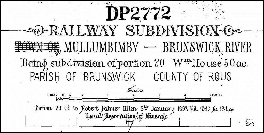
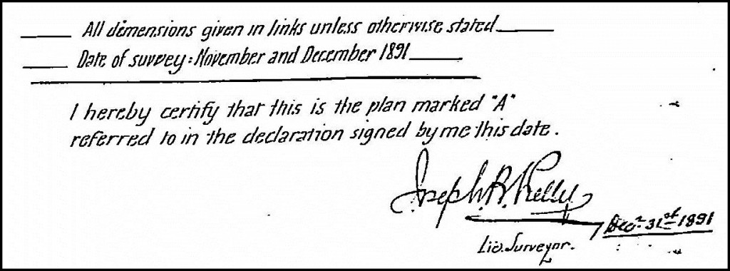
Part of the original township of Mullumbimby, in the Byron Shire, New South Wales, was set out in a rectangular grid pattern and surveyed and marked in the year 1891 by Mr. Surveyor Joseph Bede Kelly. From 1884, Surveyor Kelly was also a cane and dairy farmer at Tyagarah, Member of the NSW Legislative Assembly from 1894 to 1898 and founding Chairman of Norco in 1894. Deposited Plan of Survey number 2772 ( DP 2772 ) is a subdivision of Crown Land Portion 20, Parish of Brunswick, County of Rous. This initial land subdivision as shown in DP 2772 comprised seven sections, with a total of 266 lots created. DP 2772 describes part of the subdivided land as being dense brush, dense jungle and Section 6 noted below, as swamp in wet seasons.
Orientation of the rectangular grid and Datum line of Azimuth for DP 2772, Mullumbimby, in year 1891
With reference to Crown Portion 20, original ground survey marks found in Stuart Street and as shown in DP 2772, determine the orientation of the rectangular grid. The adopted bearing for the line joining the two survey marks found in Stuart Street, has been noted in DP 2772 as 360°. This is the Datum Azimuth or Bearing line for the year 1891 land subdivision and is supported further by an original survey mark found, shown in Station Street, with a bearing of 90° for the southern land boundary of Section 6, confirming the grid. The North Arrow with no notation in DP 2772, is orientated to the Station Street bearing of 360°. This North adopted bearing in DP 2772 is not on True North but rather, roughly approximates the direction of compass Magnetic North in the year 1891, which was the survey practice of that time. True North being the direction to the Earth’s geographic North Pole. Magnetic North is not a permanently fixed direction, but variable over time and for the location of Mullumbimby currently, moves westerly by less than 0.01 degree per annum. ( Ref : LPMA Topographic Map Sheet Brunswick Heads 9640-4N ).
True North, Central Meridian, Grid North, MGA Grid North, Grid Convergence, Magnetic North, Magnetic Variation ~ WHICH NORTH ?
A perusal of modern hardcopy topographical map sheets or online digital mapping shows the original rectangular grid of the Mullumbimby township skewed at an angle, with respect to the mapping North direction used today.
The present established mapping projection model for Australia is Map Grid Australia ( MGA ). For the Mullumbimby location, meridian of longitudge 153° East, within Zone 56, and known as the central meridian, defines the direction of MGA Grid North and the map graticule orientation.
As evidenced by more recent land boundary reinstatement surveys lodged with NSW LPMA, the bearing of Station Street with respect to MGA Grid North is about 9° 14′. This represents the existing angle of the 1891 rectangular grid to the current MGA Grid North.
At the intersection of Station and Tincogan Streets, for NSW State Survey Control Mark, PM No. 39167, the MGA Grid Convergence is 0° 14′ 24″. Applied easterly from the direction of MGA Grid North, this Grid Convergence angle gives the direction of True North from PM 39167. ( Ref : LPMA Brunswick Heads 9640-4N ).
Magnetic Variation is described as the angle between compass Magnetic North and True North. For PM 39167, this angle is about 11° 26′, for March 2011, confirmed by Geoscience Australia.
Should you have any enquiries concerning land boundary survey in Mullumbimby, Bangalow, Byron Bay or the surrounding hinterland, I offer as an experienced New South Wales Registered Land Surveyor, personal professional service and expert friendly advice, leading to successful client outcomes.
NEW SOUTH WALES NORTHERN RIVERS REGION - AUSTRALIA
BYRON BAY – BANGALOW – MULLUMBIMBY – BRUNSWICK HEADS – WATEGOS BEACH – ST. HELENA – OCEAN SHORES – SUFFOLK PARK – FEDERAL – WILSONS CREEK – BALLINA – LISMORE – TWEED HEADS – MURWILLUMBAH – LENNOX HEAD – TINTENBAR – CLUNES – BEXHILL – COORABELL – POSSUM CREEK – MYOCUM – EWINGSDALE – WANGANUI – GOONENGERRY – COOPERS SHOOT – EUREKA – MAIN ARM – CRABBES CREEK – YELGUN – CASINO – NIMBIN – BURRINGBAR – UKI – BILLINUDGEL – POTTSVILLE – WOLLONGBAR – ALSTONVILLE – MOOBALL – KYOGLE – HUONBROOK – NASHUA
Please visit my website for contact details.
An explanation of the above land related terminology, may be found in a glossary provided by the New South Wales Land and Property Management Authority (NSW LPMA).
.


