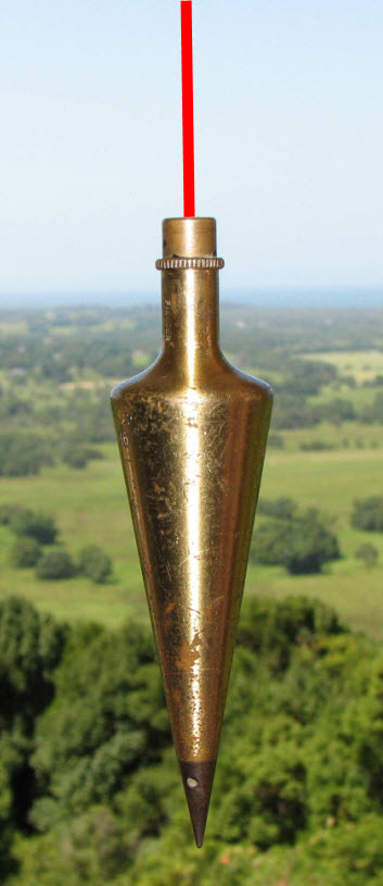
Land Surveyors CPD Workshop ~ Byron Bay, NSW ~ 13 July 2012

SHARE THE CADASTRAL EXPERTISE

Continuing Professional Development through the sharing of ideas amongst Registered Land Surveyors leading to the enhancement of professional cadastral knowledge and survey practice.

Interactive workshop format for professional Land Surveyors

Participants will be encouraged to contribute to workshop topics discussion.  Individual 3 to 5 minute participant presentations of their choice, related to the agenda, would be welcomed.  The sharing of ideas will include, and not be limited to, the nominated key topic subject matters noted below.

Limited to 10 participants only ~  in a friendly boardroom environment

Morning session   ~    9am to 12.30pm

Land boundary reinstatement analysis.

Review submitted examples, assess responses from NSW LPI; beach works protection and the location of the MHWM boundary on the ground; impact of loss of cadastral monuments.

The online cadastral Surveyor.

Available online internet resources; Land Surveyor imaging, promotion and marketing: consumer reactions; search engine impact and rationale for blogging; opportunities for CPD online.

Afternoon session   ~   1pm to 5.30pm

Cadastral business practice and the Registered Land Surveyor.

Competition in the cadastral market place; survey practice models; are there enough disclaimers; winning jobs and payment templates; affordability of land surveys and consumer reaction; perception of the Registered Land Surveyor and Local Government; job documentation as digital files.

The next 20 years, the land boundary Surveyor and cadastral surveying.

What is left for the Registered Land Surveyor, innovate or terminate;  the ” dumbing down ” of cadastral survey practice; multi-tasking for the Registered Surveyor, why; the purpose and use of the regulatory authority registration; considerations of different CPD models.

  • VENUE  The Boardroom, Lord Byron Resort, 120 Jonson Street, Byron Bay, NSW, 2481.
  • DATE  Friday 13 July 2012  ~   9am to 5.30pm
  • COST per participant  ~  $120.00
  • WORKSHOP facilitator  ~  Robert Prikulis  ~   phone  (02) 6684 7799   ~  email
  • COORDINATOR, The Boardroom  ~  Gillian Prikulis
  • HARDCOPY reference notes supplied to each participant at the beginning of the Workshop
  • 8 NSW CPD POINTS  ~  3.5 CAD & 4.5 SP 
  • EVENT code No. UN1201
  • BOSSI NSW CPD Ratifying Organization   ~  University of Newcastle 
  • LUNCH 12.30pm to 1pm, catered, with morning and afternoon refreshment breaks
  • CERTIFICATE of attendance provided at the end of the workshop
  • WORKSHOP registration, EFT payment and paid invoice  ~  email Robert
  • REGISTRATION limited to 10 participants

Land Surveyors CPD Workshop, Byron Bay, 13 July 2012

Registration closed on Friday, 6 July 2012


Surveying computations and the land boundary Surveyor

The cadastre of the Bangalow, Byron Bay and Mullumbimby districts is made up of numerous urban and rural land parcels, whose perimeter land boundary dimensions have been tested.

Created man-made ownership land boundaries have a fixed permanent location on the ground.  Natural land boundaries, for example a creek bank, may vary in ground location subject to gradual and imperceptible accretion or erosion, over a period of time.

This practising land boundary Surveyor is necessarily preoccupied with surveying computations / calculations, related to land boundaries.  The certificate of ownership or title to land, specifies the title diagram, which delineates the external perimeter dimensions of the subject land parcel.  In New South Wales ( NSW ), this diagram is usually a numbered and registered deposited plan of survey ( DP ), showing bearings and distances associated with urban or rural lots in the DP.

A former practice, now not commonly used in NSW, was to additionally provide as part of the land title documentation, a written legal metes and bounds description of the boundaries of a land parcel.  Subject land perimeter boundary bearings and distances could be extracted for checking, together with measured connections to existing property features   ~

Lot 3 commencing at a point on the northern side of William Street distant westerly 100 feet from its intersection with the western side of John Street and being the south-western corner of Lot 2 and bounded on the east by the western boundary of Lot 2 aforesaid being a line partly fenced and partly passing along the western face of a brick wall and bearing 0 ° 00′ 150 feet 0 inches to the northern boundary of the subdivided land thence on the north by part of that boundary being a fenced line bearing 270 ° 00′ 50 feet 0 inches to the north-eastern corner of Lot 4 thence on the west by the eastern boundary of Lot 4 aforesaid being a fenced line parallel to and 10 feet distant from a brick wall and bearing 180 ° 00′ 150 feet 0 inches to the northern side of William Street aforesaid and thence on the south by that side of that street bearing 90 ° 00′ 50 feet 0 inches to the point of commencement. “

The Definition of Boundaries, Handbook for Practising Land and Engineering Surveyors, H.G. Foxall.

Essential mathematical land surveying computation checks   ~  lead to proof of correctness.

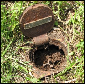
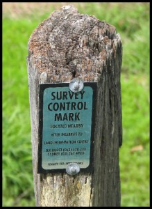
The integrity and correctness of  land boundary measurement data as shown in the modern DP, are able to be checked by survey close computation.  Field survey measurements, both bearing and distance, are also required to be tested and checked for accuracy, when locating existing ground boundary marks, when setting out new boundary corners, associated reference marking, boundary line marking or when making mandatory surveyed connections to the NSW state survey control mark system ( SCIMS ).

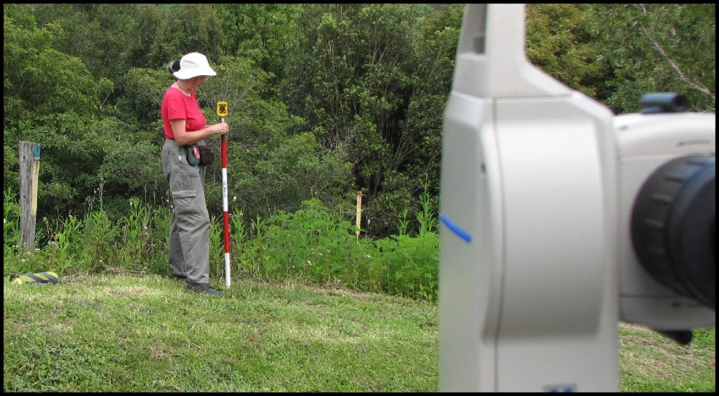
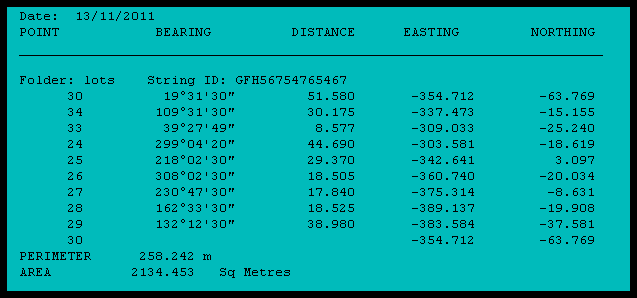
For the purpose of verification closure computations, related to checking land boundary measurements and in the determination of the relationship of building improvements to boundaries, modern technology land surveying software, in various hardware formats is available, both for the office and field.

For example, COGO and CAD computer software for the office PC, and for field use, sophisticated hand-held programmable calculators, for ease of portability and additionally for data transfer, to and from the PC.

Prior to electronics   ~   no cabling or batteries required  !

Before the widespread introduction and use of personal computers and programmable hand-held devices, how did the land surveyor undertake necessary surveying computations ?  ~   Very slowly. ~  Hand written proformas, using a book of trigonometrical tables, in conjunction with a mechanical calculator, achieved the result of confirming the correctness and accuracy of land boundary measurement survey data.  In my experience, for office use, the mechanical calculator of choice for land surveyors in the early 1960s was the FACIT, which used a numeric metal key layout and  a rotary setting lever.

For survey field use, the CURTA, made in Liechtenstein, was the preferred mechanical calculator. See pictures below.  It was elegant, compact, portable, able to be held in one’s hand and housed in a small water proof metal canister.  Used with a pocket book of trigonometrical tables, necessary survey computations could be undertaken on the spot in the field. To get an idea of the size and scale of the CURTA, the ring tab as seen in the photos below accommodates the point of one’s finger, which permits the clearing of data to allow for a new computation.

The methodology of land surveying computations and the impact on the cadastral layout pattern.

The advent of modern computer technology coupled with electronic field measuring equipment permitted a more complex layout of the urban and rural land subdivision pattern, in sympathy and integrated with, the contours and features of the landscape.  This new computerised technology removed the burden of laborious, by hand,  land surveying computations.

The early subdivision pattern of older NSW towns and rural areas, dominated by the adoption of right angled grid layouts, was partly created because of existing limitations with respect to land surveying computation technology.  This land rectangular grid layout facilitated easier survey computations, both in the office and the field, but additionally at times, took no account of the topography of the land.  Field land surveying techniques were developed to avoid computations by predominantly working with right angles and parallel offsets, where land boundaries were occupied by fences, walls, trees or vegetation.  The original township of Mullumbimby, first surveyed in the 1890s, was set out on this rectangular grid pattern.

Checks, proofs and resultant certainty in modern land boundary determination.

Ultimately, the evidence of survey markings, cadastral monuments and improvements on the ground, related to the relevant registered plan of survey, DP,  locates the correct position of a land boundary.  Precision field measurement, coupled with investigative surveying computations, facilitates a proper comparison with measurement data detailed and shown on a DP,  to actual measurements between found points and / or survey marks on the ground.

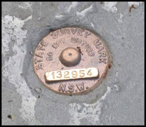
A cadastral monument is a natural or artificial object, point, or survey mark, stable in the ground, which is used for the purpose of locating or relocating a land boundary, and must be documented and referred to in a registered plan of survey or legal document on public record.

Through surveying computations, the adoption of a reinstated land boundary position, is supported and proved by measured comparison connections to other survey markings  found. The final boundary measurements determined and adopted, may not necessarily be in exact agreement with the base DP data. The accepted rule of law, is that if the position of found undisturbed cadastral monuments conflicts with measurements shown in the original registered DP,  then the doctrine of  “monuments over measurements ” applies.

A good starting point for finding online resources for land surveying computation software, applicable for both the office and field, can be found at .. Land Surveying and Geomatics Software.

Should you have any enquiries concerning land boundary investigation in the Byron, Ballina, Lismore or Tweed Shires, I offer as an experienced New South Wales Registered Land Surveyor, personal professional service and expert friendly advice, leading to successful client outcomes.

NEW  SOUTH  WALES  NORTHERN  RIVERS  REGION  -  AUSTRALIA
BYRON BAY – BANGALOW – MULLUMBIMBY – BRUNSWICK HEADS – WATEGOS  BEACH – ST. HELENA – OCEAN SHORES – SUFFOLK PARK – FEDERAL – WILSONS CREEK – BALLINA – LISMORE – TWEED HEADS – MURWILLUMBAH – LENNOX HEAD – TINTENBAR – CLUNES – BEXHILL – COORABELL – POSSUM CREEK – MYOCUM – EWINGSDALE – WANGANUI – GOONENGERRY – COOPERS SHOOT – EUREKA – MAIN ARM – CRABBES CREEK – YELGUN – CASINO – NIMBIN – BURRINGBAR – UKI – BILLINUDGEL – POTTSVILLE – WOLLONGBAR – ALSTONVILLE – MOOBALL – KYOGLE – HUONBROOK – NASHUA

Please visit my website for contact details.

An explanation of the above  land related terminology, may be found in a glossary provided  by the New South Wales Land and Property Information ( NSW LPI ), Registrar General’s Directions.

…….

Rural land subdivision in the Mullumbimby hinterland, year 2011

Stakeholders, contracts, processes and outcomes in rural land subdivision.

Mandatory local government development application approval brings certainty to the land subdivision process.

On acceptance of a land subdivision survey instruction, the NSW Registered Land Surveyor essentially also enters into a contract with the land regulatory authority, being New South Wales Land and Property Information (NSW LPI ).

In the Deposited Plan Administration Sheet, which accompanies the lodged Deposited Plan of Survey ( DP ) to NSW LPI, the Registered Land Surveyor certifies that the survey represented in the plan has been undertaken in accordance with the Surveying and Spatial Information Regulation 2006 and that the Surveyor is Registered under the Surveying and Spatial Information Act 2002.

To ensure best practice competency in the provision of land surveying services, the continuing  integrity of land boundaries in NSW and also for the protection of community interests, only surveyors registered with the NSW Board of Surveying and Spatial Information ( BOSSI ), can undertake land boundary survey and certify  formal deposited plans of land survey.

The local Council’s General Manager or  authorised representative, certifies in the Subdivision Certificate on the DP Administration Sheet, that key provisions of the Environmental Planning & Assessment Act 1979 ( EP&A Act ), have been satisfied with respect to the land subdivision.  The land owner (s) is also required to sign the Administration Sheet.

The lodged survey plan documentation, additionally requires the LPI Deposited Plan Checklist for Surveyors, to be completed and certified by the Registered Surveyor.  Any requisitions arising from survey plan examination by the NSW LPI  must be responded to by the Surveyor, who undertook the land survey.

Procedures and responsibilities in rural land subdivision.

Necessary tasks undertaken by the Registered Land Surveyor in land subdivision include, and are not limited to the following   ~ Investigative research of relevant existing plans of survey, certificates of land title and local SCIMS control survey network data.  Preliminary computations in COGO to facilitate on the ground survey investigation and precision measurement to resolve an acceptable land boundary reinstatement . Surveyed measurement connections from land boundary corners to specific survey control marks.  Computations for the field marking of new land boundaries and preparation of final plan of survey documentation, acceptable to NSW LPI.

The registration of the deposited plan of survey and subsequent issue of new land titles for the newly created lots, completes the land subdivision process.

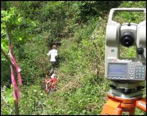
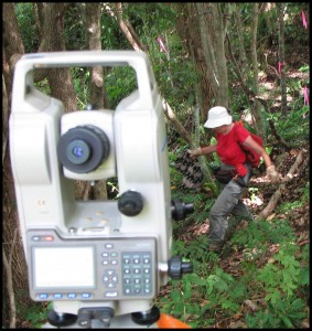
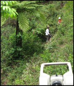
This rural land subdivision was located in the Mullumbimby hinterland about 20 minutes drive from the towns of Byron Bay and Bangalow, in the Byron Shire, far New South Wales north coast.  The photo gallery below offers an insight to some aspects of the land subdivision process, both in the field and the office.

Left click to enlarge

……….

……..


..….

Addendum ~ This rural land subdivision, undertaken by myself,  was registered as DP 118 5516 in May 2013, by the Registrar General, New South Wales Land & Property Information.

Should you have any enquiries concerning land subdivision investigation in the Bangalow, Byron Bay or Mullumbimby hinterland, I offer as an experienced New South Wales Registered Land Surveyor, personal professional service and expert friendly advice, leading to successful client outcomes.

NEW  SOUTH  WALES  NORTHERN  RIVERS  REGION  -  AUSTRALIA
BYRON BAY – BANGALOW – MULLUMBIMBY – BRUNSWICK HEADS – WATEGOS  BEACH – ST. HELENA – OCEAN SHORES – SUFFOLK PARK – FEDERAL – WILSONS CREEK – BALLINA – LISMORE – TWEED HEADS – MURWILLUMBAH – LENNOX HEAD – TINTENBAR – CLUNES – BEXHILL – COORABELL – POSSUM CREEK – MYOCUM – EWINGSDALE – WANGANUI – GOONENGERRY – COOPERS SHOOT – EUREKA – MAIN ARM – CRABBES CREEK – YELGUN – CASINO – NIMBIN – BURRINGBAR – UKI – BILLINUDGEL – POTTSVILLE – WOLLONGBAR – ALSTONVILLE – MOOBALL – KYOGLE – HUONBROOK – NASHUA

Please visit my website for contact details.

An explanation of the above  land related terminology, may be found in a glossary provided  by the New South Wales Land and Property Information ( NSW LPI ), Registrar General’s Directions.

…….

Comments on limited land title in a NSW Crown road purchase.

Considerations of the impact of a limited land title, based upon a compiled plan of survey , in the proposed closure and purchase of an existing Crown Road, as applicable to the Bangalow, Byron Bay and Mullumbimby rural hinterland.

The NSW Government regulatory authority which administers Crown roads and the conversion of Crown roads to freehold, is currently known as the Department of Primary Industries – Crown Lands Division, formerly part of the NSW Land and Property Management Authority, ( LPMA ).

The creation of land title for the sale of  part of a Crown road requires an acceptable plan of survey, referred to as the title diagram, to clearly delineate perimeter land boundaries and land area being purchased.

A successful applicant in the proposed  closure and purchase of a Crown road, and dependent upon existing land status, may be offered the option that a compiled plan of survey for the road closure be undertaken by the Department, subject to meeting the requirements of the Registrar General’s Directions, NSW Land and Property Information ( LPI ).

Compiled plan or full survey by a NSW Registered Land Surveyor ?

The acceptance of this compiled plan option may represent a cost saving to the applicant initially, but also means that no field land survey is undertaken, and that no Crown road boundaries are marked on the ground.  The relationship of existing features on the ground, related to land boundaries, are not known in a compilation plan of survey.  Additionally, specific limitations are placed on the issued land title, reflecting the use of a compiled plan, which burden upon the newly registered proprietor of an estate in fee simple.  For an example and noted below, see notation 2 in the Second Schedule of an extract from a recent  NSW Certificate of Title for a Crown road closure, based on a compilation survey.

Exclusive of the actual land purchase price, the Departmental compiled road closure plan cost represents about 10% of the combined total of LPI lodgement and Crown Lands fees for a proposed road closure and purchase. In my opinion, the fee for a Departmental Crown road closure compilation plan only, bears no relation to the reality of existing land survey costs incurred in the field survey and preparation of a plan of survey for a Crown road closure, by a NSW Registered Land Surveyor, to meet the mandatory requirements of the NSW LPI.

What actually is a compiled plan of land survey

Reliable title to land is anchored to an accurate plan of survey, resulting in the correctness of land parcel boundaries on the ground. As a special concession, the Registrar General may accept a compiled plan of survey.

A compiled plan is a plan of land survey, where some or all of the shown boundary measurements have been adopted from previous survey plan information, without any further survey on the ground. This compilation process is undertaken in the office and does not involve field survey investigation or the marking of land boundaries. The location of existing fencing and physical access to land boundaries, is not shown in a compiled plan.  The use of old or unreliable plans of survey, or survey plans subject to limited title, in the preparation of a compiled plan, is unacceptable to the Registrar General, and a full survey will be requested.

Compiled plan of road closure and limited land title cautionary disclaimer

Where a compiled road closure plan has been used as a title diagram, NSW LPI  will issue a limited title stating that ” The boundaries of the land comprised herein have not been investigated by the Registrar General “, reflecting uncertainty in actual land boundary locations on the ground and indicating that land boundaries are not guaranteed. For the land purchaser, in this instance, the rule of caveat emptor applies.

A remark land boundary survey only of part, or all, of a compiled Crown road closure, will not remove a limitation on land title.  A full formal plan of survey is required. This limitation on land title can only be removed by the lodgement to NSW LPI of a full formal plan of survey, being necessary field survey and associated plan preparation, undertaken by a Registered Land Surveyor, in accordance with the Registrar General’s Directions and the NSW Surveying and Spatial Information Regulation 2006.  The landowner is responsible for land survey costs and additional Departmental administrative lodgement fees.

An independent viewpoint on the use of limited title ~ impacting upon the  NSW Aboriginal Land Council

FACT SHEET #5: What is limited title? NSW Aboriginal Land Council ( NSWALC ) ” In short limited title means land is being returned to Aboriginal people without any completed surveying work. The limitation will not be removed from the title until the land is surveyed. This means LALCs are responsible for undertaking that work, which could cost hundreds of thousands of dollars depending on the size of the land parcel in question “.

The issue of limited title is fast becoming a major stumbling block for LALCs and NSWALC alike and one that jeopardises the economic potential of Land Rights.The process essentially ensures LALCs become unwilling heirs to immeasurable debt – as claimed land is handed back to LALCs without necessary surveying work being conducted. This results in poorly resourced LALCs being left to fund surveying work that can cost, in some cases, up to ( see letter ) dollars – depending of course on the size of the land.  In some cases, the survey required could even outstrip the value of the land.”

Should you have any enquiries concerning Crown road investigation or survey in the Bangalow, Byron Bay or Mullumbimby hinterland, I offer as an experienced New South Wales Registered Land Surveyor, personal professional service and expert friendly advice, leading to successful client outcomes.

NEW  SOUTH  WALES  NORTHERN  RIVERS  REGION  -  AUSTRALIA
BYRON BAY – BANGALOW – MULLUMBIMBY – BRUNSWICK HEADS – WATEGOS  BEACH – ST. HELENA – OCEAN SHORES – SUFFOLK PARK – FEDERAL – WILSONS CREEK – BALLINA – LISMORE – TWEED HEADS – MURWILLUMBAH – LENNOX HEAD – TINTENBAR – CLUNES – BEXHILL – COORABELL – POSSUM CREEK – MYOCUM – EWINGSDALE – WANGANUI – GOONENGERRY – COOPERS SHOOT – EUREKA – MAIN ARM – CRABBES CREEK – YELGUN – CASINO – NIMBIN – BURRINGBAR – UKI – BILLINUDGEL – POTTSVILLE – WOLLONGBAR – ALSTONVILLE – MOOBALL – KYOGLE – HUONBROOK – NASHUA

Please visit my website for contact details.

An explanation of the above  land related terminology, may be found in a glossary provided by the New South Wales Land and Property Management Authority (NSW LPMA).

.

Reviewing land boundary adjustment in the Byron Shire.

Land boundary adjustment as applicable to the Bangalow, Byron Bay and Mullumbimby hinterland

The subdivision of an individual land parcel results in the creation of new lots with separate Certificates of Title (CTs) , for the purpose of sale or development. The land subdivision may be a minimum of two smaller lots or multiple lots, depending on the proposed development. A land boundary adjustment, where land boundaries are proposed to be altered only, is considered as a land subdivision, even though no additional new lots are created. New CTs are issued to reflect the changed land boundary locations and new lot areas.

Where adjoining lands are held by separate land owners, mutual consent is required to the proposed land boundary change(s).  A development application, DA, is required to be lodged with Council, inclusive of the proposed subdivision layout, preferably prepared by a NSW Registered Land Surveyor.

There is no automatic right to a land boundary variation and no one can guarantee the outcome of a DA submission to Council. The land boundary adjustment process is not intended to replace the regulation of land subdivision through existing planning instruments, but rather to faciliate adjustments of a relatively minor nature. For example, the rectification of a building encroachment upon adjoining land, through changing the common boundary ground location.

.Land use planning policy for boundary adjustment

For the North Coast region, the NSW Department of Planning, Boundary Adjustments Policy , details the current five adopted land use planning principles.

Under the direction of the NSW Government, all Councils are now required to prepare new Local Environment Plans, LEPs, in accordance with the standard instrument LEP template. The purpose being that all LEPs across NSW will now use the same planning language, resulting in, perhaps, a better community understanding and reduced litigation.

Under Part 4, Principal development standards, of the new draft Lismore LEP, currently under community consultation, it is proposed  that, ” to adjust common boundaries between rural lots, where one or more lots is less than the minimum lot size shown on the Lot Size Map ….the subdivision will not result in a change of area of any lot of greater than 10%.“  This limitation is still in the discussion stage and will only be revealed in the final adopted LEP.

At this time, Byron Shire Council has not placed it’s draft LEP on public exhibition for community comment.

SEPP 1 and the development application process for a proposed  land boundary adjustment

As part of a submitted DA, State Environmental Planning Policy No. 1, Development Standards, SEPP 1 , may be used to apply for a land boundary adjustment between proposed rural lots, which are less than the minimum standard, as specified under the particular land use zoning in the current LEP.

The rationale of SEPP 1 is to provide Councils with the flexibility and authorisation to vary development standards, as detailed within their own environmental planning instruments, but only where it can be shown by the applicant that the compliance with the existing development standard, with regards to a particular land boundary adjustment DA, is unreasonable or unnecessary. Existing development standards, in place, referring, for example, to area, shape or road frontage constraints to lots in a proposed land boundary alteration.

The use of SEPP 1 for the justification and seeking of Council approval for a proposed land boundary location change, requires that the applicant essentially demonstrates that the proposal is consistent with both the objective of the existing planning instrument standard and additionally, local, regional and State planning objectives.

As a result of the NSW Independent Commission Against Corruption, ICAC, investigations in respect of  Wollongong City Council, several recommendations have been made in the use of SEPP 1 in the development planning approval process. Recommendations include – “ that the NSW Planning Department could have played a stronger role in regard to the council’s application of State Environmental Planning Policy (SEPP) No. 1 ; that for at least two years after the election of a new Wollongong City Council, the Director General of the Department of Planning revokes Wollongong City Council’s assumed concurrence for the use of SEPP 1 (or its equivalent) to determine departures from development standards of more than 10% ; that Wollongong City Council publish a register of DA determinations (including approvals and refusals) that rely on SEPP 1 (or its equivalent) on its website ; that when advertising or notifying development applications, Wollongong City Council disclose whether the application is accompanied by a SEPP 1 objection (or its equivalent). ”

Both land boundary adjustment and land subdivision, in consideration of Council planning approval, are treated in a similar manner. If Council refuses a boundary adjustment application, reasons are given to support its decision and the applicant has the right of appeal. Byron Shire Council maintains a SEPP 1 Objection Register.

Should you have any enquiries concerning land boundary adjustment survey in the Bangalow, Byron Bay or Mullumbimby hinterland, I offer as an experienced New South Wales Registered Land Surveyor, personal professional service and expert friendly advice, leading to successful client outcomes.

NEW  SOUTH  WALES  NORTHERN  RIVERS  REGION  -  AUSTRALIA
BYRON BAY – BANGALOW – MULLUMBIMBY – BRUNSWICK HEADS – WATEGOS  BEACH – ST. HELENA – OCEAN SHORES – SUFFOLK PARK – FEDERAL – WILSONS CREEK – BALLINA – LISMORE – TWEED HEADS – MURWILLUMBAH – LENNOX HEAD – TINTENBAR – CLUNES – BEXHILL – COORABELL – POSSUM CREEK – MYOCUM – EWINGSDALE – WANGANUI – GOONENGERRY – COOPERS SHOOT – EUREKA – MAIN ARM – CRABBES CREEK – YELGUN – CASINO – NIMBIN – BURRINGBAR – UKI – BILLINUDGEL – POTTSVILLE – WOLLONGBAR – ALSTONVILLE – MOOBALL – KYOGLE – HUONBROOK – NASHUA

Please visit my website for contact details.

An explanation of the above  land related terminology, may be found in a glossary provided by the New South Wales Land and Property Management Authority (NSW LPMA).

.

.

An insight into an original NSW Crown Portion Survey and Plan

An investigation using primary Crown Portion 13, Parish of Clunes, County of Rous, in the Byron Shire. Located at Nashua between Bangalow and Lismore, far northern New South Wales.

“ Within days of him  ( Bligh ) moving into Government House ( 1806 ), Governor King made three land grants to ( Governor ) Bligh : 240 acres on the southern fringe of the ( Sydney ) settlement, 105 acres near Parramatta and a 1000 acres near Rous Hill.” ~  Mundle, Rob.  Bligh : Master Mariner. pp 326, Sydney, Hachette Australia, 2010.

“ Of course this was not the land of no one. It could never have been terra nullius. This is just historically wrong. Therefore, if it was a land of someone, that someone, their customs and traditions were as much a source of common law as European custom and tradition had been, informing the body of Australian common law and in that law, there’s a title. It’s called Native Title.” ~ Paul Keating,  Australian Prime Minister 1991-1996, interview for ABC Television – 100 Years the Australian Story, 1997-2001.

.

In the beginning  -  The origin of Crown Land in New South Wales, Australia

Prior to the establishment of a penal colony at Sydney in 1788 by Governor Phillip, the Australian continent had been occupied by the indigenous owners for many thousands of years. The land for this penal settlement was just appropriated – with possession claimed by Governor Phillip on behalf of the British Government, in the name of the Crown, hence the terminology Crown Land.  No consultation regarding land ownership took place with the local Aboriginal inhabitants at this time. On British settlement in NSW, the resulting colonial government claimed all lands for the Crown.  Being instructed from Britain, early Governors of New South Wales were empowered to make land grants to free settlers. The Surveyor General’s office was created to administer Crown Lands.

Today, Crown Land in NSW is land owned by the State government on behalf of the people of NSW and is under the care and control of the Minister for Lands.

Extracts from Crown Portion 13, Parish of Clunes, County of Rous

click on diagrams to enlarge
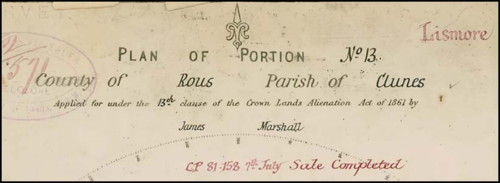
100 Links = 1 Chain = 66 Feet = 20.1168 Metres    ~  . 200  Acres = 80.937 Hectares

.

The sale of Crown Land to the private sector and the Crown Portion 13, Plan of Survey

The title heading of the Portion 13 plan of survey indicates that James Marshall applied for this 200 acre land parcel under the 13th Clause of The Crown Lands Alienation Act  of 1861, also known as The Robertson’s Alienation Act. Clause 13 introduced the alienation of Crown Land under the concept of conditional purchase (CP).  Alienation of Crown Land in the sense of the transfer of title and possession of real property. This Act also allowed for land areas to be selected before survey, as the number of qualified and capable land surveyors available  was limited at this period. The freehold title to land being granted, subject to fulfilling a specified set of conditions, usually in the form of making certain improvements, remaining on the land for a specific period of time and meeting a payment schedule. After 1831 there were no free land grants.

The red ink notation shown within the Portion 13 land parcel indicates that William Baker subsequently bought this property under conditional purchase, CP. 81.158, and conditional sale No. CS 07.49273, confirmed by issued Crown Grant Volume 1860 Folio 224, and verified by notations on the Clunes Parish Map. The Crown Grant being a legal document providing evidence to freehold land title, for what was formerly Crown Land, similar to the modern Certificate of Title.

FORMER BRITISH EMBLEM ON NSW TITLE "Dieu et mon droit " The motto of the British Monarch referring to the divine right of the Monarch to Govern.

Limits of land ownership and the delineation of Portion 13 land boundaries on the ground

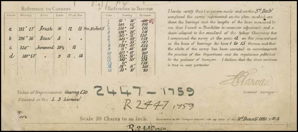
Original Portion surveys and associated Crown Portion Plans define alienated, or capable of being alienated, Crown Land. The title diagram referred to in the Crown Grant for Portion 13, is the Crown Plan of Portion 13, with a Crown Plan 2447-1759  reference number. The small number 1759, indicates that this Portion plan is within the County of Rous.

The field survey for Portion 13 was completed by Licensed Surveyor, Mr. C. F. Garvan in December 1881, in accordance with ” the practice of this Department ( NSW Lands ) and the regulations published for the guidance of Surveyors “, and as dutifully stated by the Surveyor’s declaration in the lower right hand corner of the plan.

Land boundaries were necessarily required to be discernible on the ground to the new land owner.

Current NSW land boundary survey practice requirements are known as the Surveying and Spatial Information Regulation 2006.

Land boundary survey of original Crown Portion 13

Mr. Surveyor Garvan’s task was to undertake both precision length ( in links ) and angular measurement land surveying, to set out an exact  200 acre land parcel, incorporating a separate road reserve and a Wilsons Creek bank boundary. Survey computations, using trigonometrical tables, confirmed to the Surveyor what boundary lengths to adopt to lay out the correct land area. The portion boundaries were orientated on the cardinal ( 0° or 90°, north and east ), approximate orientation to Magnetic North, with no bearings shown on the cardinal lines on the portion plan.

Ground survey markings wholly determined the land boundary locations, which were not related to the true north meridian.

Within the measured Portion 13 Plan, part of the terrain, in 1881, is described as ” mountainous dense cedar scrub . The earliest settlers to the Bangalow, Byron Bay and Mullumbimby  hinterland were not seeking a seachange, but rather, attracted to the financial rewards of logging the valuable natural red cedar timber resource.

Subtropical heat, intermittent rain and insects, bush camp living, travel by horse was the survey field party’s continuous experience, when surveying land boundaries with link chain and theodolite, in the sometimes challenging NSW far North Coast  Big Scrub terrain.

The survey field party, comprising of several chainmen and axemen, led by Licensed Surveyor, Mr. C. F. Garvan, measured and marked the land and road boundaries, as required by the existing Survey Regulations, and additionally, located the position of the creek boundary bank to cardinal boundarys by survey traverse. The mathematical accuracy of the overall survey, in compliance with existing regulations, could be tested by closure computations of  measured bearings and distances. The tabulated creek traverse shown on the portion plan has a red ink amendment for traverse line number one.

For future reinstatement, the main pegged and lockspitted  portion corners were connected by survey to specially marked reference trees.  For example, at the north west corner of Portion 13, noted as ” C “, a reference Ironwood tree was cut with a horseshoe shield, marked with a government broad arrow and the number 13. From the  broad arrow point to the actual true portion corner, being a measured bearing of 324°00′ and horizontal distance, 19.5 links. The Portion 13 cardinal boundary lines were blazed, the purpose being to physically locate the land boundary position in thickly timbered country. With reference to the tree diagram, existing trees on the boundary line were double blazed on both sides and trees within two paces of the boundary, with a single blaze, being a horseshoe shield cut into the trees.

What is the relevance of the 1881 Crown Portion survey to this Land Surveyor in 2011 ?

Today, evidence of the original boundary survey markings of the 1881 survey are long gone. Registered Deposited Plans of Survey ( DPs ) indicate that Portion 13 has been subsequently subdivided on three separate occasions. Recently, I was requested to locate and mark part of  the still existing unconstructed crown road reserve in relation to the old southern boundary of Portion 13. None of the more recent DPs detailed the road boundary bearings and distances. That necessary information could only be obtained reliably from the original Crown Portion 13  Plan.

Existing land boundaries prior to the Colonial initiated Crown Portion Survey and Plan

” Over thousands of years Indigenous people have lived in Australia developing a unique system for signposting and marking the land. This system is interconnected with stories of the Dreaming and Spirit Ancestors. Indigenous people use natural features of the landscape to identify and mark the land and its significance. Many Indigenous children learn these “mental maps” of their countries and about how places relate to each other and to people.”  ~ The Australian Museum, The Land, Indigenous Land Use.

.

The dispossession of indigenous land by the colonisation of  NSW in 1788,  was partly redressed with the introduction of the NSW Aboriginal Land Rights Act 1983. Local Aboriginal Land Councils were offered the opportunity to  make  formal claims for  particular Crown Lands. Under Clause 36 of this Act, claimable Crown Lands were lands ” vested in Her Majesty “, unalienated Crown Land, not lawfully used or occupied, or not needed or are likely to be needed as residential lands, or not needed for an essential public purpose. Under this legislation, many successful claims have been determined, inclusive of old crown portions, which have been transferred to Land Councils for their use and control.

“ He selected on a run at Dry Hole Creek, and for months awaited the arrival of the Government surveyors to fix his boundaries; but they didn’t come, and, as he had no reason to believe they would turn up within the next ten years, he grubbed and fenced at a venture, and started farming operations. “   ~ Settling on the Land  ~ Henry Lawson – 1893  ~ Lawson, Henry, A Camp Fire Yarn, Complete Works 1885-1900.

.

Should you have any enquiries concerning land boundary survey in the Bangalow, Byron Bay or Mullumbimby hinterland, I offer as an experienced New South Wales Registered Land Surveyor, personal professional service and expert friendly advice, leading to successful client outcomes.

NEW  SOUTH  WALES  NORTHERN  RIVERS  REGION  -  AUSTRALIA
BYRON BAY – BANGALOW – MULLUMBIMBY – BRUNSWICK HEADS – WATEGOS  BEACH – ST. HELENA – OCEAN SHORES – SUFFOLK PARK – FEDERAL – WILSONS CREEK – BALLINA – LISMORE – TWEED HEADS – MURWILLUMBAH – LENNOX HEAD – TINTENBAR – CLUNES – BEXHILL – COORABELL – POSSUM CREEK – MYOCUM – EWINGSDALE – WANGANUI – GOONENGERRY – COOPERS SHOOT – EUREKA – MAIN ARM – CRABBES CREEK – YELGUN – CASINO – NIMBIN – BURRINGBAR – UKI – BILLINUDGEL – POTTSVILLE – WOLLONGBAR – ALSTONVILLE – MOOBALL – KYOGLE – HUONBROOK – NASHUA

Please visit my website for contact details.

An explanation of the above  land related terminology, may be found in a glossary provided by the New South Wales Land and Property Management Authority (NSW LPMA).

.


Affordable land at Wategos Beach, Byron Bay, NSW, in 1961

Future options for land affordability from a Surveyor’s perspective in the Byron Shire & beyond

Some background information  ~  Income and Costs for the period 1960 to 1962

  • Cost of brand new 8′ 6″, 2 stringer, Barry Bennett Malibu surfboard, 1962,  £38 Pounds 10s Shillings. Correspondence with Barry Bennett, Bennett Surfboards P/L..
  • Cost of an allotment of land, Wategos Beach, Byron Bay, NSW Department of Lands, Crown Lands Subdivision, first auction, 25 November 1961, about £350 Pounds and less. NSW Government Gazette, 20 October 1961, pp. 3298-3299. Local anecdotal evidence and 2010 newspaper article published online.
Note:  The changeover date from Australian Pounds to decimal currency Dollars was 14 February 1966.
.

Left click to enlarge photos

Movie screenshots from Bruce Brown’s movie “Surfing Hollow Days” - filmed in 1961 and released in 1962, showing the Wategos Beach locality, Byron Bay, in 1961.  The two movie stills show the initial preparation of the engineering road works for the Wategos Beach Crown Lands subdivision. Fifty years ago in 2011. Left picture, Julian Rocks is in the background.

.

A New South Wales Government Initiative 1961

The Wategos Beach Crown land subdivision was a NSW Government development commenced by the Lands Department in about 1961. Several land sale auctions took place, the first being undertaken on 25 November 1961. As evidenced by income and costs, almost fifty years ago, land at Wategos Beach, Byron Bay, could be construed to be accessible and affordable to the broader local community in 1961. Today, property is exchanged at Wategos Beach in the multi million dollar range.  I speculate that current existing NSW State and Local Government land use planning and environmental protection regulations, probably, would not have allowed this land development to proceed today.

Wategos Beach Crown Lands Subdivision, showing allotments, sections and administrative notations. Extract from NSW Department of Lands, Town of Byron Bay, Sheet 1, Status Branch Charting Maps. Orientation magnetic north.

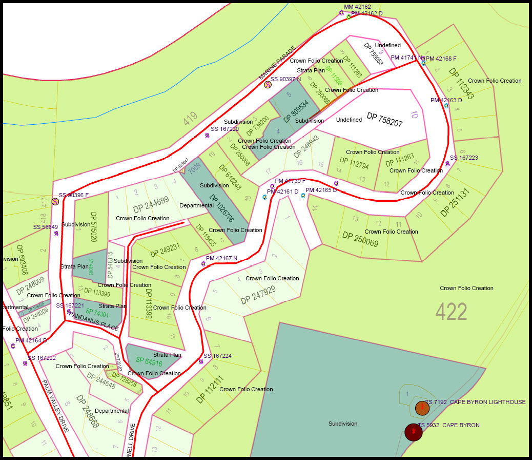
Wategos Beach Crown Lands Subdivision showing Deposited Plan numbers, allotments and survey control points.Trigonometrical station, Cape Byron Lighthouse, lower right hand corner.  Source NSW Land and Property Management Authority (LPMA), February 2011. Orientation MGA Grid North.

.

Future options for consideration  ~ Land cost ~ the key determinant, leading to “affordable housing “. 

  • The land policy makers to release more land stock for urban and rural housing. By increasing the supply, demand may be dampened and land prices stabilised or reduced. Create more choice and competition in the urban and rural housing mix.
  • Today’s younger community is becoming disenfranchised with respect to land and home ownership. New models for urban and rural housing are required. For selected and appropriate locations, lessen the requirements for land subdivision utility infrastructure, reduce building structure requirements, both without compromising personal safety, control Local Government fees and limit development conditions of consent,  with a view to providing genuine “affordable housing” offering the security of an individual land title to a property owner.
  • Permit building entitlements for selected closed Crown and Council roads.
  • Assess the opportunity of developing Crown Land for affordable housing by way of Conditional Purchase, title being granted on a set of conditions being met – eg. the owner to reside on the land,  minimum building improvements to be constructed within a set time frame and the land not to be sold for a specified number of years.
  • Revisit and reintroduce a new form of the previously successful NSW Concessional Allotment Scheme, which enabled a rural land owner to subdivide a specified number of lots smaller than the allowable subdivision requirement, from the existing holding.   Each new subdivided lot having a building entitlement. Place initiative in the control of the land owner and the community. This proposed scheme would not be applied to and exclude, environmentally protected and hazardous lands.

Perhaps my recommendations may be wishful thinking, however, their consideration at least may promote further investigation and much needed action in this important issue.

Should you have any enquiries concerning land boundary survey in Byron Bay or the surrounding hinterland, I offer as an experienced New South Wales Registered Land Surveyor, personal professional service and expert friendly advice, leading to successful client outcomes.

NEW  SOUTH  WALES  NORTHERN  RIVERS  REGION  -  AUSTRALIA
BYRON BAY – BANGALOW – MULLUMBIMBY – BRUNSWICK HEADS – WATEGOS  BEACH – ST. HELENA – OCEAN SHORES – SUFFOLK PARK – FEDERAL – WILSONS CREEK – BALLINA – LISMORE – TWEED HEADS – MURWILLUMBAH – LENNOX HEAD – TINTENBAR – CLUNES – BEXHILL – COORABELL – POSSUM CREEK – MYOCUM – EWINGSDALE – WANGANUI – GOONENGERRY – COOPERS SHOOT – EUREKA – MAIN ARM – CRABBES CREEK – YELGUN – CASINO – NIMBIN – BURRINGBAR – UKI – BILLINUDGEL – POTTSVILLE – WOLLONGBAR – ALSTONVILLE – MOOBALL – KYOGLE – HUONBROOK – NASHUA

Please visit my website for contact details.

An explanation of the above  land related terminology, may be found in a glossary provided by the New South Wales Land and Property Management Authority (NSW LPMA).

.

.

North Orientation and the Mullumbimby Township year 1891

Which north ?  ~  a land surveyor’s cadastral observation for the year 2011

Left click to enlarge

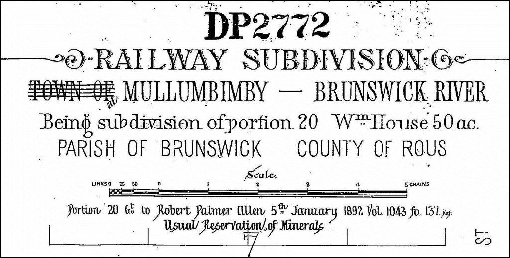
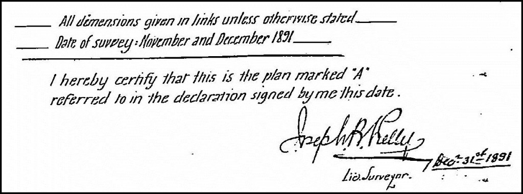
Part of the original township of Mullumbimby, in the Byron Shire, New South Wales, was set out in a rectangular grid pattern and surveyed and marked in the year 1891 by Mr. Surveyor Joseph Bede Kelly. From 1884, Surveyor Kelly was also a cane and dairy farmer at Tyagarah, Member of the NSW Legislative Assembly from 1894 to 1898 and founding Chairman of Norco in 1894. Deposited Plan of Survey number 2772  ( DP 2772 )  is a subdivision of Crown Land Portion 20, Parish of Brunswick, County of Rous. This initial land subdivision as shown in DP 2772 comprised seven sections, with a total of 266 lots created.  DP 2772  describes part of the subdivided land as being dense brush, dense jungle and Section 6 noted below, as swamp in wet seasons.

Orientation of the rectangular grid and Datum line of Azimuth for DP 2772, Mullumbimby, in year 1891

With reference to Crown Portion 20, original ground survey marks found in Stuart Street and as shown in DP 2772, determine the orientation of the rectangular grid. The adopted bearing for the line joining the two survey marks found in Stuart Street, has been noted in DP 2772 as 360°.  This is the Datum Azimuth or Bearing  line for the year 1891 land subdivision and is supported further by an original survey mark found, shown in Station Street, with a bearing of  90° for the southern land boundary of Section 6, confirming the grid. The North Arrow with no notation in DP 2772, is orientated to the Station Street bearing of  360°. This North adopted bearing in DP 2772 is not on True North but rather, roughly approximates the  direction of compass Magnetic North in the year 1891, which was the survey practice of that time. True North being the direction to the Earth’s geographic North Pole. Magnetic North is not a permanently fixed direction, but variable over time and for the location of Mullumbimby currently, moves westerly by less than 0.01 degree per annum.  ( Ref : LPMA Topographic Map Sheet  Brunswick Heads 9640-4N ).

True North, Central Meridian, Grid North, MGA Grid North, Grid Convergence, Magnetic North, Magnetic Variation  ~  WHICH NORTH ?

A perusal of modern hardcopy topographical map sheets or online digital mapping shows the original rectangular grid of the Mullumbimby township skewed at an angle, with respect to the mapping North direction used today.

The present established mapping  projection model for Australia is Map Grid Australia ( MGA ).  For the Mullumbimby location, meridian of longitudge 153° East, within Zone 56, and known as the central meridian, defines the direction of  MGA Grid North and the map graticule orientation.

As evidenced by more recent land boundary reinstatement  surveys lodged with NSW LPMA, the bearing of Station Street with respect to MGA Grid North is about  9° 14′.  This represents the existing angle of the 1891 rectangular grid to the current MGA Grid North.

At the intersection of Station and Tincogan Streets, for NSW State Survey Control Mark, PM No. 39167, the MGA Grid Convergence is 0° 14′ 24″.  Applied easterly from the direction of MGA Grid North, this Grid Convergence angle gives the direction of True North from PM 39167.  ( Ref : LPMA  Brunswick Heads 9640-4N ).

Magnetic Variation is described as the angle between compass Magnetic North and True North.  For PM 39167, this angle is about 11° 26′, for March 2011, confirmed by Geoscience Australia.

Should you have any enquiries concerning land boundary survey in Mullumbimby, Bangalow, Byron Bay or the surrounding hinterland, I offer as an experienced New South Wales Registered Land Surveyor, personal professional service and expert friendly advice, leading to successful client outcomes.

NEW  SOUTH  WALES  NORTHERN  RIVERS  REGION  -  AUSTRALIA
BYRON BAY – BANGALOW – MULLUMBIMBY – BRUNSWICK HEADS – WATEGOS  BEACH – ST. HELENA – OCEAN SHORES – SUFFOLK PARK – FEDERAL – WILSONS CREEK – BALLINA – LISMORE – TWEED HEADS – MURWILLUMBAH – LENNOX HEAD – TINTENBAR – CLUNES – BEXHILL – COORABELL – POSSUM CREEK – MYOCUM – EWINGSDALE – WANGANUI – GOONENGERRY – COOPERS SHOOT – EUREKA – MAIN ARM – CRABBES CREEK – YELGUN – CASINO – NIMBIN – BURRINGBAR – UKI – BILLINUDGEL – POTTSVILLE – WOLLONGBAR – ALSTONVILLE – MOOBALL – KYOGLE – HUONBROOK – NASHUA

Please visit my website for contact details.

An explanation of the above  land related terminology, may be found in a glossary provided by the New South Wales Land and Property Management Authority (NSW LPMA).

.