Land boundary survey for Ros at Wanganui in the Byron Shire

Rural Identification Survey to relate Residence Building to land and creek bank boundaries.

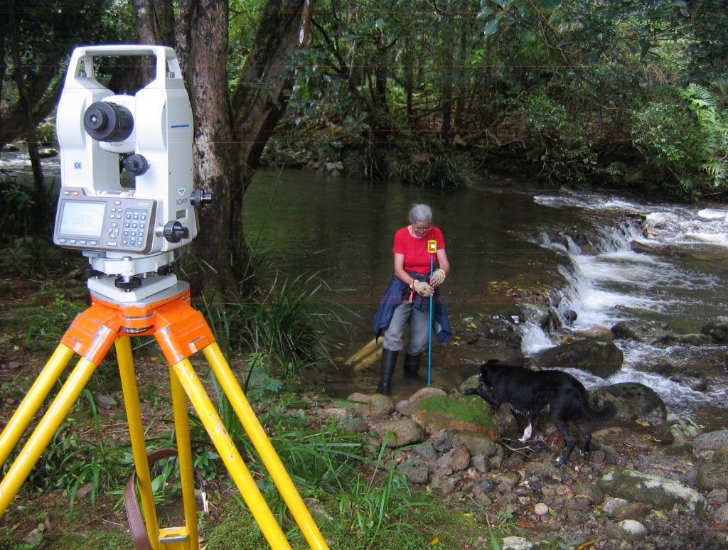
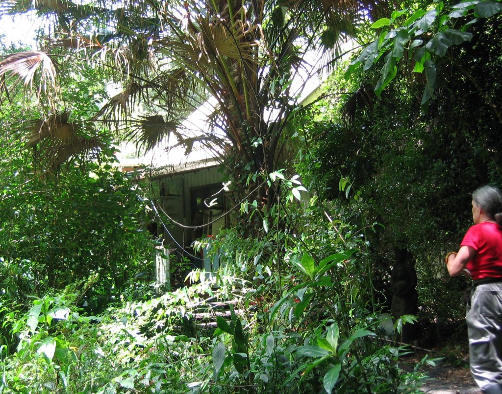
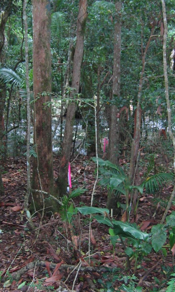
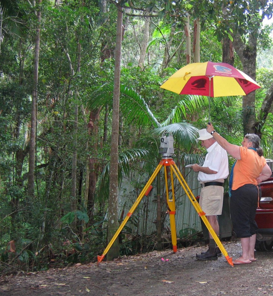
Selected photographs taken during the field survey investigation phase.

Left click to enlarge photos

A special thank you, Ros, for commissioning the survey of your property and for giving your permission to publish these selected photographs, taken during the field work phase on 21 January 2011.


Measuring land surveying instrumentation used in undertaking this field survey  ~  Sokkia Total Station for precision bearing and distance measurement and Suunto Compass for preliminary approximate orientation.

Should you have any enquiries concerning the reinstatement of your land boundaries associated with an Identification or boundary remark survey in Mullumbimby or the surrounding hinterland, I offer as an experienced New South Wales Registered Land Surveyor, personal professional service and expert friendly advice.

NEW  SOUTH  WALES  NORTHERN  RIVERS  REGION  -  AUSTRALIA
BYRON BAY – BANGALOW – MULLUMBIMBY – BRUNSWICK HEADS – WATEGOS  BEACH – ST. HELENA – OCEAN SHORES – SUFFOLK PARK – FEDERAL – WILSONS CREEK – BALLINA – LISMORE – TWEED HEADS – MURWILLUMBAH – LENNOX HEAD – TINTENBAR – CLUNES – BEXHILL – COORABELL – POSSUM CREEK – MYOCUM – EWINGSDALE – WANGANUI – GOONENGERRY – COOPERS SHOOT – EUREKA – MAIN ARM – CRABBES CREEK – YELGUN – CASINO – NIMBIN – BURRINGBAR – UKI – BILLINUDGEL – POTTSVILLE – WOLLONGBAR – ALSTONVILLE – MOOBALL – KYOGLE – HUONBROOK – NASHUA

Please visit my website for contact details.

An explanation of the above  land related terminology, may be found in a glossary provided by the New South Wales Land and Property Management Authority (NSW LPMA).

.

How your land subdivision is controlled by Local Government.

In my experience, the legitimate prospect of profit is the underlying motivation for a land subdivision developer. The NSW Registered Land Surveyor’s involvement is fundamental to the overall land subdivision process.

Primary Legislation impacting upon a proposed less complex land subdivision development.

The subdivision of an individual land parcel results in the creation of new lots with separate Certificates of Title (CTs) , for the purpose of sale or development. The land subdivision may be a minimum of two smaller lots or multiple lots, depending on the proposed development. A land boundary adjustment, where land boundaries are proposed to be altered only, is considered as a land subdivision, even though no additional lots are created. New CTs are issued to reflect the changed land boundary locations.

The key New South Wales ( NSW ) legislation that controls how land subdivision and associated development can occur in a particular locality, is the NSW  Environmental Planning and Assessment Act 1979 ( EP & A  Act ). Through State environmental planning  policies, SEPPs, regional and local environmental plans, REPs & LEPs, and local development control plans, DCPs, State and Local government apply development control processes for a land subdivision.

Council Development Application ~ The Subdivision Certificate ~ The Registered Land Surveyor’s role.

Development consent is required from the Local Council to subdivide land.

The approval process for a less complex land subdivision requires the lodgement of a formal development application ( DA ),  to the local Council. From the outset, it is recommended that a Registered Land Surveyor be involved with the design of the proposed subdivision layout. This would also necessarily require some preliminary survey field work to be undertaken on the ground. It is mandatory that the final plan of subdivision be prepared by a Registered Land Surveyor, accordingly, the Surveyor’s early participation in the DA process avoids potential problems.

A milestone, but not the end of the subdivision process, occurs when the Council signs off the Subdivision Certificate, which certifies that all DA consent conditions have been met, inclusive of any works in accordance with the Construction Certificate. A land subdivision is completed when the final plan of subdivision, sometimes referred to as the linen plan, together with the Council endorsed subdivision certificate, is lodged with the NSW Land and Property Management Authority ( LPMA ). On subdivision plan examination and subsequent registration by LPMA,  the land is formally subdivided and separate land titles are issued.

Council’s considerations in deciding whether or not to give DA approval for a proposed subdivision.

Depending on the extent and type of proposal, typical issues that a Council would expect to have addressed in a formal DA for a proposed land subdivision, could include, but not limited to, some of the following matters  -

Compliance with State, Regional and local Council land use planning instruments, social and environmental impacts, land capability assessment, land title investigation, aerial imagery, topographic mapping information, contours, features, existing building structures, detailed plan of the proposed subdivision, roads and accesses, land acquisition for road widening, easements, recreation space, geotechnical investigation, flood prone lands, provision of utility services, water, sewerage and drainage, power and phone supply, effluent disposal, soils and contaminated lands, erosion control, trees and vegetation protection, impact on threatened species, fauna and flora, high conservation value biodiversity management, bushfire hazard risk management, Aboriginal cultural heritage protection, landscape scenic amenity, impact on adjoining property owners, impact of climate change and sea level rise  – and this list could go on.

Additionally, if Council considers it warranted, the DA submission can be placed on public exhibition for community comment.

Outcome of  Council’s assessment of the Development Application for land subdivision.

Under the  EP & A  Act, Council notifies the applicant of it’s determination of the submitted DA for the proposed land subdivision. If the development is refused and not approved, usually specific reasons are given. If Council consent is granted for the land subdivision, this approval is subject to a schedule of conditions, which must be fulfilled. To ensure that all consent conditions are met, Council will not endorse or release the Subdivision Certificate, until all consent conditions are complied with. As noted previously, the final plan of subdivision, lodged with LPMA, for the creation of CTs for new lots, must be accompanied with the Council endorsed Subdivision Certificate. This is detailed in the Administration Sheet for the lodged subdivision plan.

In my local experience, I have observed Council consent conditions for a smaller land subdivision eg. less than seven lots, to be in my opinion, both numerous and onerous. I note also that developer contributions are required to be paid before the issue of the Subdivision Certificate.  I recommend careful reading and assessment of Council’s schedule of conditions of approval.

For a smaller land subdivision, the overall time scale from lodgement of DA to Council, to the issue of new CTs  by LPMA, can be up to several months plus and with more complex, larger subdivisions, years plural.

Right of Review and Appeal to a local Council’s Determination for a land subdivision development.

Under the EP & A  Act, if an applicant is not happy with Council’s determination or issued conditions of consent, an application may be submitted to Council requesting modifications. If dissatisfied with Council’s response, then the applicant may appeal to the NSW Land and Environment Court. A personal risk management assessment, particularly in consideration of financial implications, will dictate which road to travel. No one can guarantee the outcomes of a Development Application to Council or an appeal to a Court of Law  ~

Should you have any enquiries concerning the preparation of  a proposed land subdivision layout or the preparation of a final plan of land subdivision, I offer, as an experienced New South Wales Registered Land Surveyor, personal professional service and expert friendly advice.

NEW  SOUTH  WALES  NORTHERN  RIVERS  REGION  -  AUSTRALIA
BYRON BAY – BANGALOW – MULLUMBIMBY – BRUNSWICK HEADS – ST. HELENA – OCEAN SHORES – FEDERAL – WILSONS CREEK – BALLINA – LISMORE – TWEED HEADS – MURWILLUMBAH – LENNOX HEAD – TINTENBAR – CLUNES – BEXHILL – COORABELL – POSSUM CREEK – MYOCUM – EWINGSDALE – WANGANUI – GOONENGERRY – COOPERS SHOOT – EUREKA – MAIN ARM – CRABBES CREEK – YELGUN – CASINO – NIMBIN – BURRINGBAR – UKI – BILLINUDGEL – POTTSVILLE – WOLLONGBAR – ALSTONVILLE – MOOBALL – KYOGLE – HUONBROOK – NASHUA

Please visit my website for contact details.

An explanation of the above  land related terminology, may be found in a glossary provided by the New South Wales Land and Property Management Authority (NSW LPMA).
Land boundary reinstatement and survey costs

A non-technical explanation for the land owner or purchaser.

“The true nature of the boundary surveyor’s role lies not in theories of exact measurement, but in the proposition that the basic determinant of the limits of any region in respect of which some person or body holds exclusive legal rights, is not a matter of surveying, but a matter of law.”
Frank M. Hallman, 1973, ” Legal Aspects of Boundary Surveying as apply in NSW.”


Land survey costs are influenced by the age of original land survey information, being public records of land title and plans of survey, the property size, shape and value, liability exposure for the Surveyor, the topography, the terrain and vegetation of the land parcel itself, accessibility to the property corners and importantly, any existing evidence on the ground, of land boundary survey monumentation. ie. Objects or marks, shown in the original registered plan of survey that are related to the land boundaries. These ground markings are known as monuments. Where monuments are gone or disturbed, the field survey component for a property survey is generally required to be extended, until reliable survey markings are found.

I advise that survey costs are dependent, in part, upon the necessary background research required for the land parcel itself and the extent of ground field survey and survey computations required to properly re-establish the original land boundaries. The total effort and time involved necessarily reflects the cost.

The actual investigative land surveying process is known as the land boundary reinstatement.

The process starting point is the Certificate of Title, CT, of the subject property, which nominates the title diagram. This diagram  shows  boundary lengths and bearings for the subject lot and adjoining lots.  In NSW this is usually a numbered Deposited Plan of Survey, DP, detailing lot(s) in a dimensioned plan of land subdivision.

The DP can be a plan of actual survey of land or a compiled plan, meaning a plan of land where some or all of the shown boundary measurements have been adopted from previous survey information, without further survey on the ground. If the property CT is based on a compiled plan(s), it is prudent to obtain the original surveyed DPs used in  the compilation preparation.

The metes and bounds  – mathematics and land boundary markings.

The NSW  DP,  plan of survey, is a plan of mathematical integrity and is able to be checked  for reliability. Dimensions shown, being bearings and distances of lot land boundaries, can be tested for correctness and accuracy by survey closure computation. This mathematical framework is known as the metes.

At the initial time of marking of an original land survey or land subdivision, as well as the placement of boundary corner and line marks, reference marks to corners are also placed to facilitate future land boundary reinstatement. An additional layer of reference marking to land boundary corners are mandatory surveyed connections to found and placed NSW state control survey marks, referred to as the NSW Survey Control Information Management System, SCIMS.

Features and survey markings that reliably anchor the metes to the ground  are known as the bounds. In common law, the evidence of the bounds generally carries more weight than the metes. Hence the land surveyor’s adage  -  monuments before measurement. In modern NSW cadastral survey practice, the metes and bounds are usually in agreement.

The COGO mathematical model and the original plan of survey.

COGO software is a suite of programs used for solving coordinate geometry problems as applicable to land surveying. Computations are undertaken in a precision drawing environment with the capability of exporting data to an enhanced CAD format.

Through the COGO computation process, a mathematical model of coordinates on a local datum can be determined for relevant lot corners, reference marks and control points shown in a DP plan of survey for the land boundaries being investigated. These generated coordinates taken from the tested original plan of survey, are utilised to validate evidence found in the subsequent field measurement survey.

Field measurement survey on the ground.

For a particular property survey, be it urban or rural land, initially, any relevant evidence of  prior land boundary monumentation is searched for and located on the ground. For example and not limited to  -  old survey pegs and associated reference marking, old original fencing or SCIMS survey control points.

These found monuments are surveyed, measuring bearing and horizontal distance by closed traverse and checked radiations, utilising precision total station surveying equipment or if appropriate, by high precision GPS equipment.

Using COGO and on a different coordinate datum to the original plan of survey, checked coordinates are determined for the monuments located and found on the ground in the field survey.

Original plan and field survey measurement comparison.

Two separate mathematical coordinate models are now available for original plan and field survey comparison assessment. The bearing and distance between monuments found can be compared against bearing and distance computed from the original survey plan. An evaluation can then be made as to which monuments are to be adopted as reliable and correct, or which to reject. Based on acceptable evidence of monumentation, land boundaries are reinstated on the ground to the location where they were originally surveyed.

Utilising adopted proven monuments, the separate coordinate models are now able to be merged by rotation and translocation, bringing the original plan of survey and field traverse survey together into one mathematical coordinate model. This will now facilitate, if necessary, the finding of further monumentation to prove a land boundary, the marking of a land boundary or the relating of an existing building structure to a boundary.

The Registered Land Surveyor’s responsibility.

The American surveying authority, Curtis M. Brown, sums up the reinstatement process as follows, “The duty of the surveyor is to locate the lines exactly as run by the original surveyor and to gather sufficient evidence so that a judge and jury can be convinced that the re-established line is the original line run by the original surveyor.” (Frank M. Hallman,  ibid)

Should you have any uncertainty about the correct location of a land boundary on the ground, I offer, as an experienced New South Wales Registered Land Surveyor, personal professional service and expert friendly advice.

NEW SOUTH WALES NORTHERN RIVERS REGION  -  AUSTRALIA
BYRON BAY – BANGALOW – MULLUMBIMBY – BRUNSWICK HEADS – ST. HELENA – OCEAN SHORES – FEDERAL – WILSONS CREEK – BALLINA – LISMORE – TWEED HEADS – MURWILLUMBAH – LENNOX HEAD – TINTENBAR – CLUNES – BEXHILL – COORABELL – POSSUM CREEK – MYOCUM – EWINGSDALE – WANGANUI – GOONENGERRY – COOPERS SHOOT – EUREKA – MAIN ARM – CRABBES CREEK – YELGUN – CASINO – NIMBIN – BURRINGBAR – UKI – BILLINUDGEL – POTTSVILLE – WOLLONGBAR – ALSTONVILLE – MOOBALL – KYOGLE – HUONBROOK – NASHUA

Please visit my website for contact details.

An explanation of the above  land related terminology, may be found in a glossary provided by the New South Wales Land and Property Management Authority (NSW LPMA).
Caveat emptor and your piece of Australia

An update on Lines in Space pdf

A proposed real estate purchase, be it vacant land or property with building improvements, can sometimes be a daunting task. A myriad of issues are required to be considered. Caveat emptor, let the buyer beware, applies in a property transaction.

From this Land Surveyor’s perspective, fundamental to a proposed property transaction, is an understanding of the limits of actual land ownership i.e. the land parcel boundaries and associated impacts, if any, upon the land itself.

In New South Wales, the cornerstone document is the Certificate of Title attached to the subject land. Primary essential information is set out in the title document.

The type of land boundary related defects, revealed by field survey investigation, in my recent experience, have included the following :

  • Urban and rural fencing not correctly located to land boundaries.
  • A rural property purchaser, shown on the ground, a significantly incorrect property boundary location.
  • Encroachment of building structures upon adjoining lands, public roads and easements.
  • Encroachment of building structures on an unconstructed Crown road reserve within the subject property.
  • Building structures not located within the designated building envelope and not in accordance with the restriction(s) on the use of land as described in the Section 88B Instrument.
  • Property has no legal access or legal access via an unconstructed Crown road, but practical access over adjoining land without an easement.
  • Practical access is not within the designated easement for a right of carriage way.
  • Constructed road access is not within the public road reserve and encroaches upon the adjoining property.
  • In a worst case scenario, all building improvements were located on the wrong land parcel.

A proposed land and property purchaser may be advised by their legal representative, to obtain a survey from a NSW Registered Land Surveyor, before sale finalisation.  The purchaser declines this recommendation, possibly on the basis of cost.  Subsequently, a notation of the purchaser’s response refusal is made on the contract sale documentation, by the legal representative.  Post sale completion, should a major defect be found regarding land boundaries and / or the location of property improvements, who then carries this liability ?

Where a land boundary survey is undertaken affecting interests in land, e.g. easements, restriction (s) on use of land, right of way, and lodged with the NSW  Registrar General, on registration of the plan of survey, it is prudent to check the new issued land titles, to confirm that the affecting interests are noted in the notations section of the Certificates of Title.  A manager gets what he or she inspects, not what they expect.  Accordingly, never assume, always check.

See addendum 29 March 2012.

An explanation of the above land related terminology may be found in a glossary provided by the New South Wales Land and Property Management Authority (NSW LPMA).
Should you have any land boundary or title concerns with a proposed real estate purchase or your existing property, I offer, as an experienced New South Wales Registered Land Surveyor, personal professional service and expert friendly advice.

NEW SOUTH WALES NORTHERN RIVERS REGION  -  AUSTRALIA
BYRON BAY – BANGALOW – MULLUMBIMBY – BRUNSWICK HEADS – ST. HELENA – OCEAN SHORES – FEDERAL – WILSONS CREEK – BALLINA – LISMORE – TWEED HEADS – MURWILLUMBAH – LENNOX HEAD – TINTENBAR – CLUNES – BEXHILL – COORABELL – POSSUM CREEK – MYOCUM – EWINGSDALE – WANGANUI – GOONENGERRY – COOPERS SHOOT – EUREKA – MAIN ARM – CRABBES CREEK – YELGUN – CASINO – NIMBIN – BURRINGBAR – UKI – BILLINUDGEL – POTTSVILLE – WOLLONGBAR – ALSTONVILLE – MOOBALL – KYOGLE – HUONBROOK – NASHUA

Please visit my website for contact details.

Escarpment lands II ~ Background history

” The subject land forms one of the most important landscape features of the Shire.”

p 100, Report to the Council of the Shire of Byron – February 1987,                                                                    Office of the Commissioners of Enquiry for Environment and Planning.

Protection measures for escarpment lands in the New South Wales Byron Shire were created with the establishment of the Byron Local Environment Plan in the year 1988.

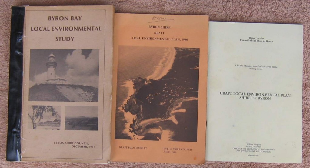
The rationale for the 7 (d) Scenic / Escarpment Protection Zone was detailed in the publication, Byron Bay Local Environmental Study, Byron Shire Council 1981.  This study identifies the Coorabell / Ewingsdale escarpment lands as regional prominent  landscapes.” Important vistas and landscape features are to be protected. p 16….. Lands such as the escarpment lands behind Byron Bay were identified as being of prime landscape value and stringent planning controls were recommended to be applied here. p 19 “

The Byron Shire Draft Local Environment Plan, 1986, states with respect to the Scenic / Escarpment Zone that “the major objective of this Zone is to protect and enhance areas of major scenic quality in the Shire.”

Quote Visually prominent / scenic areas ~ Inappropriately located rural settlement can ultimately destroy the very scenic amenity of an area which attracted residents in the first place.  Preserving the dominant landscape features or scenic characteristics of an area is fundamental to ensuring that the visual rural qualities of the Shire (i.e. prominent ridges, bushland or timber, creeks, views, aspect, etc.) are not further diminished by future rural settlement.  ~   As a minimum starting point, the Strategy excludes all lands zoned in the Byron LEP 1988 as  7(d) (Scenic / Escarpment Zone ) from future rural settlement in the Shire.” ~ Extract from the ” Byron Rural Settlement Strategy 1998 ~ Best Practice Guidelines and Performance Standards ” ~ Page 99

As evidenced by current site modifications on protected escarpment lands, the adherence to policies introduced more than twenty years ago have now become watered-down or non-existant, with detrimental effects to  the escarpment environment.  Perhaps the Byron Shire Council should take charge and demonstrate that it is truly serious about the environmental management of sensitive escarpment lands.


original publications covers

Escarpment lands under pressure

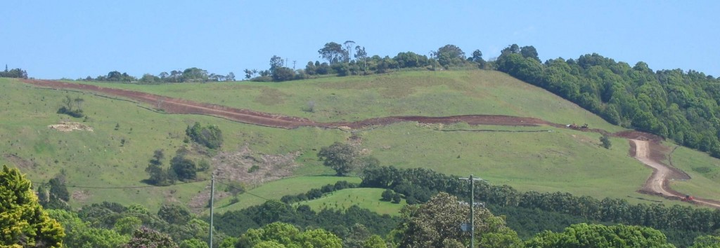
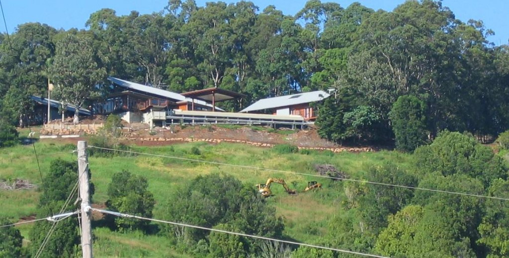
One cannot help but notice the visual impact of new development on the face of the escarpment in the Coorabell locality in the New South Wales Byron Shire.

Access roads crisscrossing the escarpment face and building structures that stand out and cannot go un-noticed.  These infrastructures are located on environmentally sensitive lands, that are supposed to be protected by existing land use planning legislation. Much more care should have been taken in their placement.

It seems that this type of development is now becoming the norm, with little or no restraint action being taken by the regulatory authorities. Over the years I have made representation to Local Government and relevant Government Agencies, generally receiving inadequate responses.

If the local government authority is not prepared to uphold its own planning policy in the Coorabell Escarpment locality, being a 7 (d) Scenic / Escarpment Protection Zone, then the proper protection of environmentally sensitive lands is lost now, and to future generations.

The Land Surveyor has always had a close relationship with the land. Associated with my work, at least, are accepted responsibilities in the consideration of social and environmental consequences which may impact upon the land.

Be informed, it is all too late when the noise of the earthmoving machinery is heard.

11 March 2010 update –  In response to requests, example photographs are provided. Left click to enlarge photos.

Taken from Myocum Road 2 October 2008

Taken from Myocum Road 9 March 2010

Taken from Kennedys Lane 16 October 2009

Taken from Kennedys Lane 9 March 2010

Coorabell Escarpment ~ Source ~ Google Map ~ added 13 April 2011